Johnson & Browning
Johnson's Georgia and Alabama
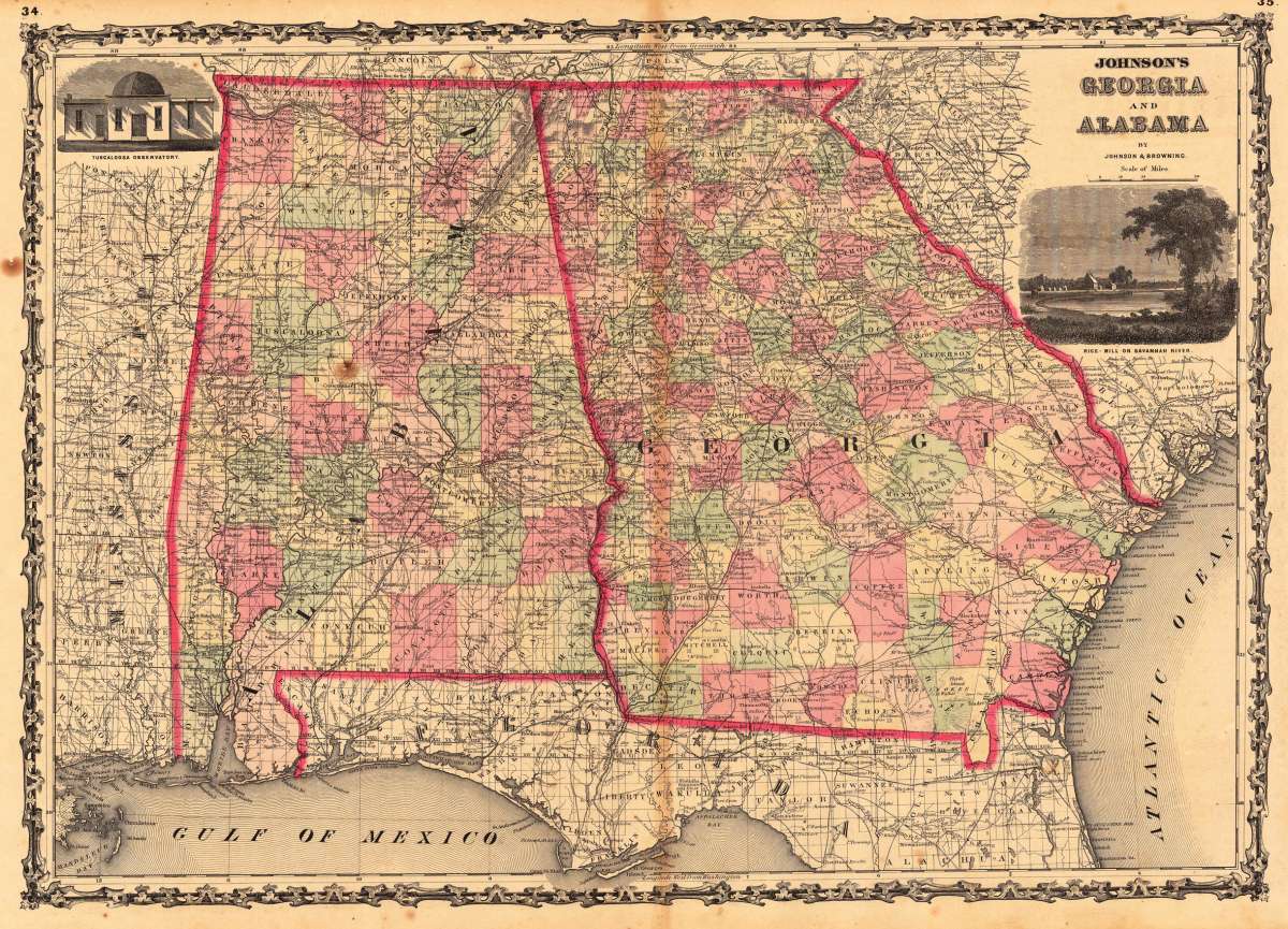
Johnson & Browning – Johnson's Georgia and Alabama · Antique Map, Lithograph · 395 x 560mm · New York 1859
Eigenschaften
- Published: New York
- Published date: 1859
- Type: Antique Map, map
- Technique: Lithograph / Original color.
- Issue date: 1859
- Category: Georgia
- Size: 395 by 560mm (15 by 22 inches).
- Stock number: 14163
- Condition: In very good to excellent condition. Two minor brown spots, one within the image of the map. 395 by 560mm (15 by 22 inches).
Article description
Article description
Lithograph, hand-colored in outline by Johnson & Browning, published 1859 by New York. Image size: 395 by 560mm (15 by 22 inches). From Johnson's New Illustrated Family Atlas — the leading American atlas of the Civil War era. A.J. Johnson (Alvin Jewett Johnson, 1827–1884) launched his celebrated atlas series after acquiring Colton's plates in 1860, initially publishing as Johnson & Browning before reorganizing as Johnson & Ward in 1863. Johnson's New Illustrated Family Atlas became the dominant American commercial atlas of the Civil War era, offering detailed steel-engraved state and regional maps with vivid hand-applied outline coloring. These atlases were sold by subscription and reached a vast American audience, making them among the most widely distributed — and today most collectible — American maps of the 19th century. This antique map shows the southern states Georgia and Alabama. Inside the map are many place names, rivers, etc. The map has in the upper right and left corner insets, which show the Rice-Mill on Savannah River and the Tuscaloosa Observatory. In very good to excellent condition. Two minor brown spots, one within the image of the map.Johnson & Browning – Johnson's Georgia and Alabama · Antique Map, Lithograph · 395 x 560mm · New York 1859
You might also be interested in the following products
 Gray's New...
 Lithograph, original color in outline by Gray, Frank, published 1884 by O.W. Gray & Son, Philadelphia. Image...
€70.00
 Amér.Sep....
 Lithograph, hand-colored in outline by Vandermaelen, Phillippe Marie, published 1825 by Brussels. Image size: 463 by...
€177.00
 L'Ancien et...
 Copper Engraving, uncolored by Bonne, Rigobert, published 1787 by M. Bonne, Paris. Image size: 346 by 235mm (13 by 9...
€195.00
 Neueste Karte von...
 Steel Engraving, hand-colored in outline by Meyer, Joseph & Radefeld, Carl, published 1851 by Bibliograph....
€100.00
Recently viewed products