Bromme, Traugott
Vereinigte Staaten von Nordamerika
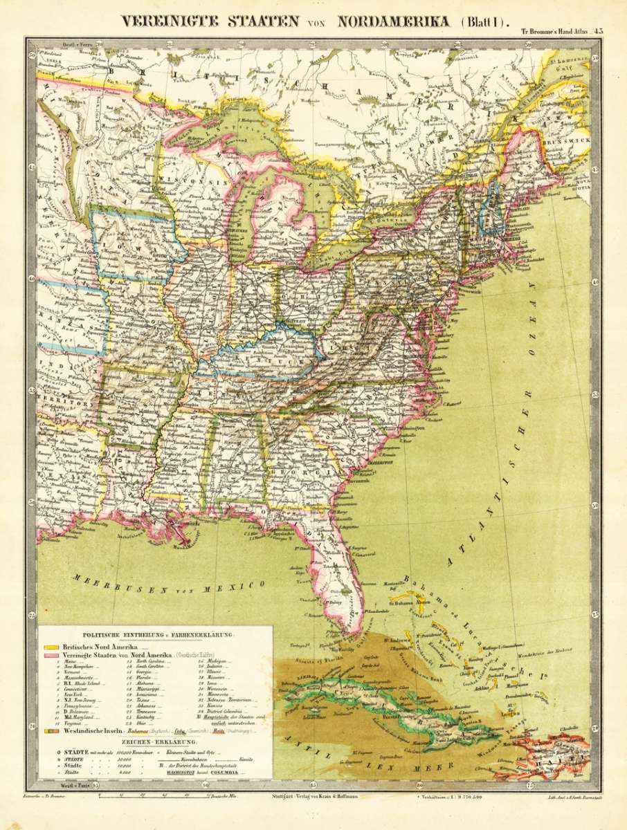
Bromme, Traugott – Vereinigte Staaten von Nordamerika · Antique Map, Lithograph · 375 x 288mm · Hoffm.Verlagsbuchhandlung, Stuttgart 1855
Eigenschaften
- Published: Hoffm.Verlagsbuchhandlung , Stuttgart
- Published date: 1855
- Type: Antique Map, map
- Technique: Lithograph / Original color.
- Issue date: 1855
- Category: Eastern United States
- Size: 375 by 288mm (14 by 11 inches).
- Stock number: 14249
- Condition: In excellent condition. 375 by 288mm (14 by 11 inches).
Article description
Article description
Lithograph, hand-colored in outline by Bromme, Traugott, published 1855 by Hoffm.Verlagsbuchhandlung, Stuttgart. Image size: 375 by 288mm (14 by 11 inches). Traugott Bromme (1802–1866) was a German-American author and cartographer who emigrated to the United States and later returned to Germany, where he wrote prolifically about American geography and immigration. His maps and atlases for German emigrants were among the most practical and accurate available to 19th-century German-speaking readers considering emigration to North America. An uncommon map of the Eastern United States published in T. Bromme's Handatlas around 1850. A very detailed map showing the Eastern United States, remarkable in its details on place names and political borders. Bromme who traveled with his brother in the 1820s in North America published later travel guides in Germany. The map is equipped with many place names, rivers, lakes, etc. In the lower left corner is a detailed table of explanations. An interesting map for the collector of the Atlantic Seaboard. In the south it extends towards Florida, Cuba and the Bahamas. In excellent condition.Bromme, Traugott – Vereinigte Staaten von Nordamerika · Antique Map, Lithograph · 375 x 288mm · Hoffm.Verlagsbuchhandlung, Stuttgart 1855
You might also be interested in the following products
 Delaware and...
 Lithograph, color by Johnson & Ward, published 1862 by Johnson & Ward, New York. Image size: 400 by 320mm (15...
€90.00
 (Vermont - New...
 Lithograph, hand-colored in outline by Smith, J. Calvin, published 1845 by Th. Fischer, Cassel. Image size: 370 by...
€295.00
 Gray's New...
 Lithograph, original color in outline by Gray, Frank, published 1884 by O.W. Gray & Son, Philadelphia. Image...
€95.00
 Gray's New...
 Lithograph, original color in outline by Gray, Frank, published 1884 by O.W. Gray & Son, Philadelphia. Image...
€95.00
Recently viewed products