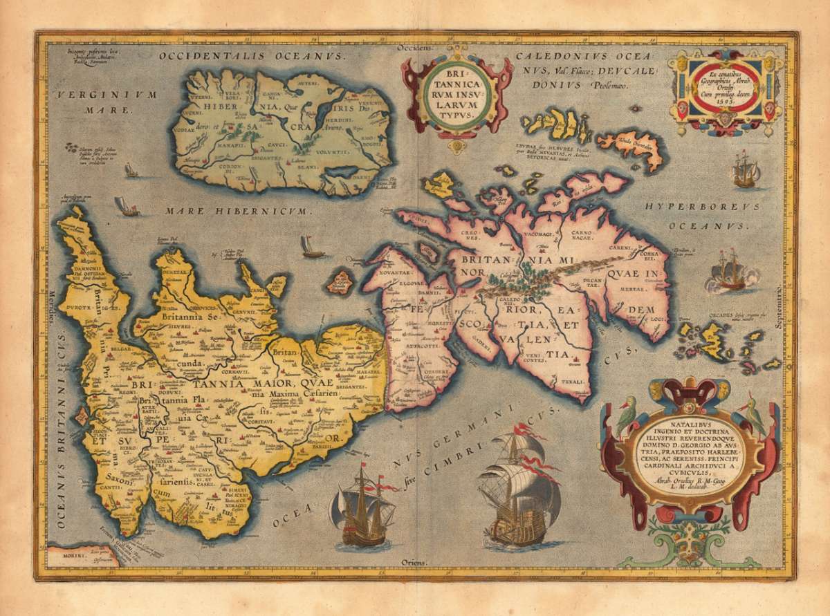
Ortelius, Abraham
Britannicarum Insularum Typus.


Prices incl. VAT plus shipping costs
This item is sold. Please contact us if you are searching for this item.
- Published: Balthasar Moretus , Antwerp
- Published date: 1624
- Type: Antique Map, map
- Technique: Copper engraving / later handcolor
- Category: England
- Issue date: 1624
- Size: 367 by 511mm (14 by 20 inches).
- Bibliography: Koe. Ort. 46; Broe. 192 ( Perergon 1624 Latin text edition signature xj); Shirley (1991) maps 186 (pl. 71), 259a, 365.
- Stock number: 14983
- Condition: In excellent condition.
Article description
Original copper engraving, published 1624 at B. Moretus in Ortelius' historical Atlas" Parergon'. Finely hand-colored in wash and outline. This antique historical map was published from 1595 to 1624 onwards in various edition of the Theatrum and the Parergon. The map is ornated with three cartouches, in the upper middle the title cartouche, in the upper right corner we find a cartouche with the "privilegium". On the lower right side cartouche with text. Villages and towns are shown as miniature views, moreover the map is ornated with ships. A fine and decorative historical map of the British Isles. This map by Abraham Ortelius is based on the modern information of Mercator" s 1564 map of the British Isles, as well improved by a new outline from Saxton's 1579 map and ancient knowledge from Diodorus Siculus, Plinius, Appianius, Tacitus, Caesar and Strabo. The map was engraved by Jan Wierix. Ortelius was born on 14 April 1527 in the city of Antwerp, which was then in the Habsburg Netherlands (modern-day Belgium). The Orthellius family were originally from Augsburg, a Free imperial city of the Holy Roman Empire. In 1535, the family had fallen under suspicion of Protestantism. Following the death of Ortelius's father, his uncle Jacobus van Meteren returned from religious exile in England to take care of Ortelius. Abraham remained close to his cousin Emanuel van Meteren, who would later moved to London. In 1575 he was appointed geographer to the king of Spain, Philip II, on the recommendation of Arias Montanus, who vouched for his orthodoxy. He travelled extensively in Europe and is specifically known to have traveled throughout the Seventeen Provinces; in southern, western, northern, and eastern Germany (e.g., 1560, 1575–1576); France (1559–1560); England and Ireland (1576); and Italy (1578, and perhaps twice or thrice between 1550 and 1558). Beginning as a map-engraver, in 1547 he entered the Antwerp Guild of Saint Luke as an illuminator of maps. He supplemented his income trading in books, prints, and maps, and his journeys included yearly visits to the Frankfurt book and print fair, where he met Gerardus Mercator in 1554. In 1560, however, when travelling with Mercator to Trier, Lorraine, and Poitiers, he seems to have been attracted, largely by Mercator's influence, towards the career of a scientific geographer. (Wikipedia)
Koe. Ort. 46; Broe. 192 ( Perergon 1624 Latin text edition signature xj); Shirley (1991) maps 186 (pl. 71), 259a, 365.
You might also be interested in the following products
 Moluccae Insulae...
  Pascaert van...
  Pascaarte vande...
  Guiana sive...