Weigel, Christoph
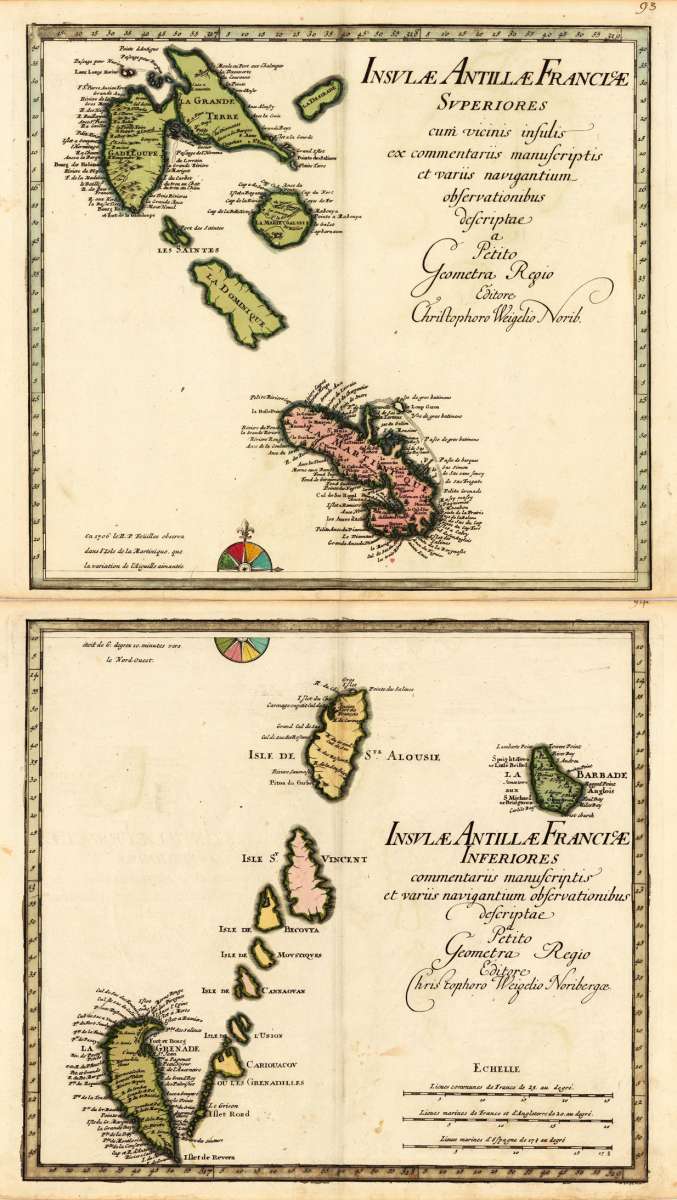
Insulae Antillae Francicae Superiores cum vicinis insulis ex commentariis manuscriptis et variis navigantium...
Prices incl. VAT plus shipping costs
Free of shipping costs!
This item is sold. Please contact us if you are searching for this item.
- Published: C. Weigel , Nürnberg
- Published date: 1719
- Technique: Copper engraving / Original color.
- Type: Antique Map, map
- Issue date: 1719
- Category: Antilles
- Size: 635 by 365mm (25 by 14 inches).
- Stock number: 15501
- Condition: In excellent condition. 635 by 365mm (25 by 14 inches).
Article description
Original antique copper engraving, hand colored in outline and wash when published. A strong and fine impressions of the map of the French Antilles by Chr. Weigel. Johann Christoph Weigel, known as Christoph Weigel the Elder (9 November 1654 – 5 February 1725), was a German engraver, art dealer and publisher. He was born at Redwitz, Free imperial city of Eger in Egerland, and died in Nuremberg, aged 70. The cartographer Weigel worked around 1719 in Nürnberg and his maps are showing the typical style of this period in map making in Southern German. He worked very close as with Johann B. Homann in Nürnberg. All his maps were hand colored in outline and decorative body color immediatelly in his printing house, after they were printed.
You might also be interested in the following products
 Pas kaart Van de...
  Isle de la...
  Isle De La...
  Martinico to...