Blair, John
A map of the West Indies and Middle Continent of America from the latest Observations by John Blair L.L.D. & F.R.S....
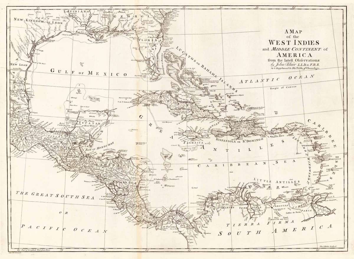
Eigenschaften
- Published: J. Blair , London
- Published date: 1779
- Type: Antique Map, map
- Technique: Copper engraving / Uncolored
- Category: West Indies
- Issue date: 1779.
- Size: 417 by 580mm (16½ by 22¾ inches).
- Stock number: 15524
- Condition: In excellent condition. The map was originally published folded, so that the old folds are still slightly visible. 417 by 580mm (16½ by 22¾ inches).
Article description
Article description
Copper engraving, uncolored, engraved by Thomas Kitchin. The map shows the West Indies, Florida, the Southern United States, the Golf of Mexico and Central America.
You might also be interested in the following products
 Neueste Karte von...
 Steel engraving, hand colored in outline when published. A detailed map of the West Indies, Panama and Central...
€132.00
 Charte Von...
 Copper engraving in contemporary original color in outline. Unusual map of the West Indies published by the Austrian...
€195.00
 Arcipelago delle...
 Lithograph, hand colored in outline when published. Geographical map from the "Geographical Atlas with Information...
€320.00
Recently viewed products