Theunis, Jacobsz & Lootsman, Jacob and Casparus
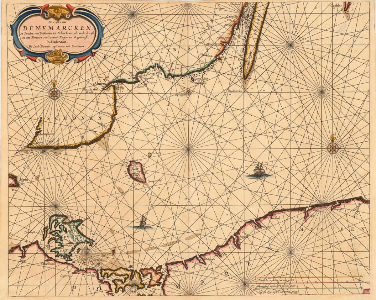
De Custen van Denemarcken, en Sweden, van Valsterbon tot Schenckenes, als mede de custen van Pomeren van 't...
Eigenschaften
- Published: Jacques & Gasper Anthoine , Amsterdam
- Published date: 1662
- Type: Antique Map, map
- Issue date: 1662
- Technique: Copper engraving / later handcolor
- Category: Baltic Sea - Sweden - Rügen - Denmark
- Size: 432 by 533mm (17 by 21 inches).
- Bibliography: Koeman Jac. 14 (and a variant of Jac 33) #26
- Stock number: 15951
- Condition: A decorative handcoloured map, in a strong impression and excellent condition. 432 by 533mm (17 by 21 inches).
Article description
Article description
Detailled seachart of a part of the Baltic Sea with the Southern Swedish coast from Schoenen towards Calmer with the island of Oeland. As well the islands Meun, Bornholm, Rügen and the Southern tip of Gothland are shown. Below is the Pommeranian coastline from Stralsund towards Rygshooft, showing prominent the island of Rügen. The map is equipped with many details, names of towns and villages along the coastlines, anchor places, islands and sandbanks with marked depths. The map is ornated in the upper left corner with a large title-cartouche, one compass-rose and a ship. In the lower right corner we find a milage scale to convert Dutch, Spanish, English & French leagues to degrees.Koeman Jac. 14 (and a variant of Jac 33) #26
You might also be interested in the following products
 Fionia
 Original antique copper engraving, uncolored. Published in the first Cloppenburgh edition of Gerhard Mercator's...
€150.00
 Südliches...
 Published in Meyer's "Handatlas", a very good copy in contemporary hand color in outline. Detailed...
€100.00
 Südliches...
 A very good example of this map by Radefeld, published in Meyer's "Handatlas", contemporary colored in...
€95.00
 Prospect der...
 Original antique copper engraving in contemporary hand color in wash and outline when published. Impressive and...
€550.00
Recently viewed products