Flemming, Carl
Vereinigte Staaten Von Nord-America
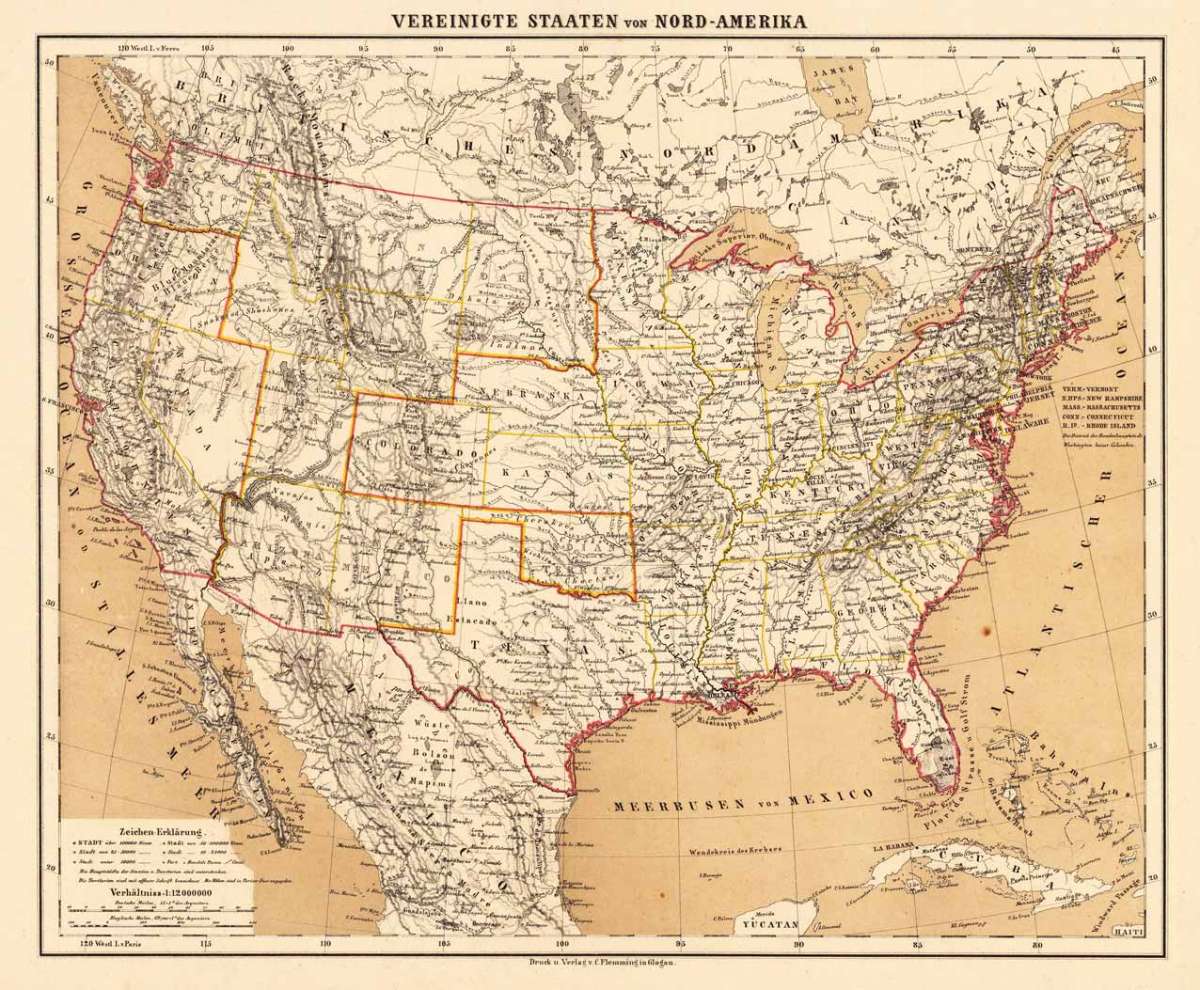
Flemming, Carl – Vereinigte Staaten Von Nord-America · Antique Map, Lithograph · 335 x 410mm · Glogau, Flemming 1865
Eigenschaften
- Published: Glogau , Flemming
- Published date: 1865
- Type: Antique Map, map
- Category: North America
- Technique: Lithograph / Original color.
- Issue date: 1865
- Size: 335 by 410mm (13 by 16 inches).
- Stock number: 17028
- Condition: A remarkable fresh copy published in an edition around 1860, the sea already printed in brown colors. A decorative copy in excellent condition. 335 by 410mm (13 by 16 inches).
Article description
Article description
Lithograph, color by Flemming, Carl, published 1865 by Glogau, Flemming. Image size: 335 by 410mm (13 by 16 inches). Carl Flemming was a German publisher based in Glogau (now Głogów, Poland) who produced geographical atlases and maps in the mid-19th century. His maps of North America from the 1840s–1860s, printed by lithography with careful hand-applied outline coloring, offered German-speaking audiences an up-to-date picture of the rapidly expanding United States and British North America, incorporating the most recent survey information available from American sources. An excellent example of Flemming's map of the United States, showing detailed the borders of the United States and its territories. Many cities and small towns are marked, as well forts, Indian territories, early exploration routes and other details. A remarkable fresh copy published in an edition around 1860, the sea already printed in brown colors. A decorative copy in excellent condition.Flemming, Carl – Vereinigte Staaten Von Nord-America · Antique Map, Lithograph · 335 x 410mm · Glogau, Flemming 1865
You might also be interested in the following products
 United States...
 Lithograph, hand-colored in outline by Philip, George & Son, published 1852 by Liverpool. Philip & Son. Image...
€130.00
 Vereinigte...
 Copper Engraving, hand-colored in outline by Mollo, Tranquillo, published 1807 by Mollo, Vienna. Image size: 320 by...
€345.00
![Antique Special-Karte der Vereinigten Staaten von Nordamerika. [folded maps in cardboard cover]](https://bergbook.com/media/image/cd/c6/1d/20600_500x500@2x.jpg "Special-Karte der") Special-Karte der...
Special-Karte der... Lithograph, color by Smith, J. Calvin, published 1845 by Theodor Fischer, Kassel. Image size: 1440 by 1840mm (56 by...
€4,200.00
 Ètats-Unis D...
 Copper Engraving, hand-colored in outline by Buchon, Jean Alexandre, published 1825 by J. Carez, Paris. Image size:...
€480.00
Recently viewed products