Kiepert, H.
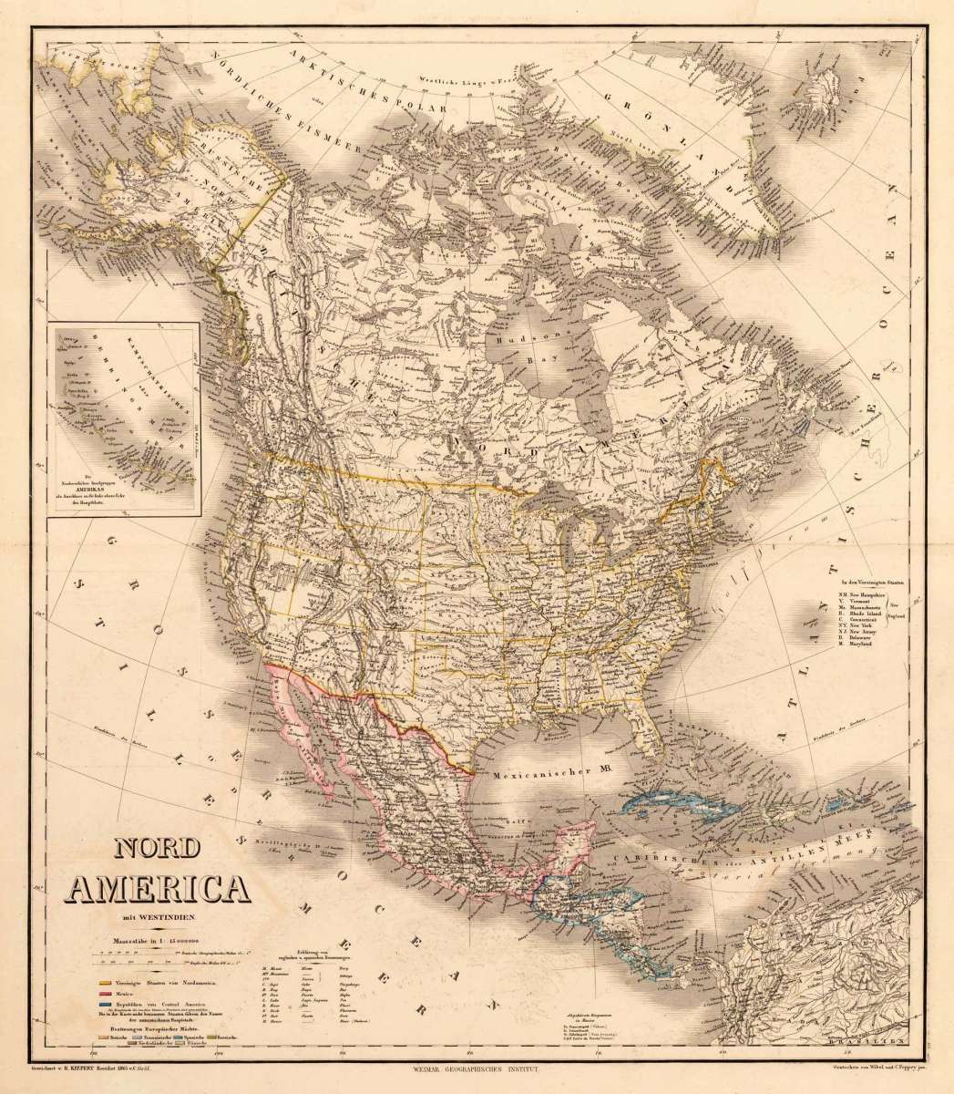
Nord America mit West Indien.
Eigenschaften
- Published: Geographisches Institut , Weimar
- Published date: 1865
- Type: Antique Map, map
- Category: North America
- Issue date: 1865
- Technique: engraving, originSteel al color
- Size: 592 by 512mm (23 by 20 inches).
- Stock number: 17032
- Condition: In excellent condition. 592 by 512mm (23 by 20 inches).
Article description
Article description
Steel engraving, hand colored in outline when published. Decorative doublepage handcolored engraved map, showing North America around 1865. The map extends from the east with Greenland and reaches towards Russian America (Alaska) with the Bering Street. In the South with the gulf of Mexico and Central America. At the left side ornated with a small inset map, showing the the northwestern Fuchs Islands in the Bering Sea. The map provides additional information, especially in the West, many Indian territory names are given. Mountains and rivers are as well marked very well. Handcolored in outline, engraved by Wibel and C. Poppey jun. At the bottom we find explanations for English and Spanish names, as well there is table with the color keys for the various posessions. This map is the revised edition engraved by by Wibel and C. Poppey jun. and published 1865 in Weimar.You might also be interested in the following products
 Amerique...
 Copper engraving, hand colored in outline and wash when published. Fine engraved map of the state of North America...
€480.00
 America...
 Copper engraving, hand colored in wash when published. This map of North America published by G. Tasso in Venice is...
€475.00
 L' America...
 Copper engraving, hand colored in wash when published. These two maps are showing North and South America. They...
€160.00
 Flusskarte von...
 Steel engraving, hand colored in outline and wash when published. The two maps are showing detailed river maps of...
€48.00
Recently viewed products