Lotter, Tobias Conrad
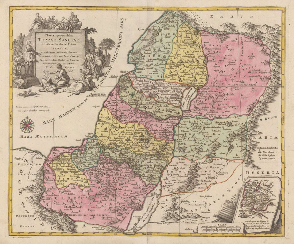
Charta geographica Terrae Santae Divisa in duodecim Tribus Israelis, et exihibens accurate itinera Salvatoris Nostri...
€480.00
Prices incl. VAT plus shipping costs
This item is sold. Please contact us if you are searching for this item.
Eigenschaften
- Published: Lotter , Augsburg
- Published date: 1762
- Technique: Copper engraving / Original color.
- Type: Antique Map, map
- Issue date: 1762
- Category: Holy Land
- Size: 488 by 578mm (19¼ by 22¾ inches).
- Stock number: 17313
- Condition: In excellent condition. 488 by 578mm (19¼ by 22¾ inches).
Article description
Article description
Copper engraving handcolored in wash and outline, when published. Engraved ca. 1762 by Georg Friedrich Lotter in Augsburg. Decorative map of the Holy Land divided up in its twelve tribes. This detailled map of the Holy Land is ornated in the lower right corner with a small inset map, a well in the upper right corner with a large allegoric decorative title cartouche.You might also be interested in the following products
 Ierusalem aus den...
 Original antique copper engraving, hand colored in outline and wash when published. This map was published in the...
€250.00
 La Judée ou Terre...
 Copper engraving, hand colored in outline, when published. Detailed map by the French cartographer Sr. Robert de...
€295.00
 Palaestina, Vel...
 Fine copper engraved map, printed into the full text page, published in 'Geografia ... Universale de la...
€175.00
 Victoire...
 Copper engraving, uncolored as published. Historical scene, showing an extensive land battle, in the background an...
€95.00
Recently viewed products