Radefeld, Hauptmann von
Neueste Karte von England nach den besten Quellen entworfen u. gezeichnet vom Hauptm. Radefeld. 1844
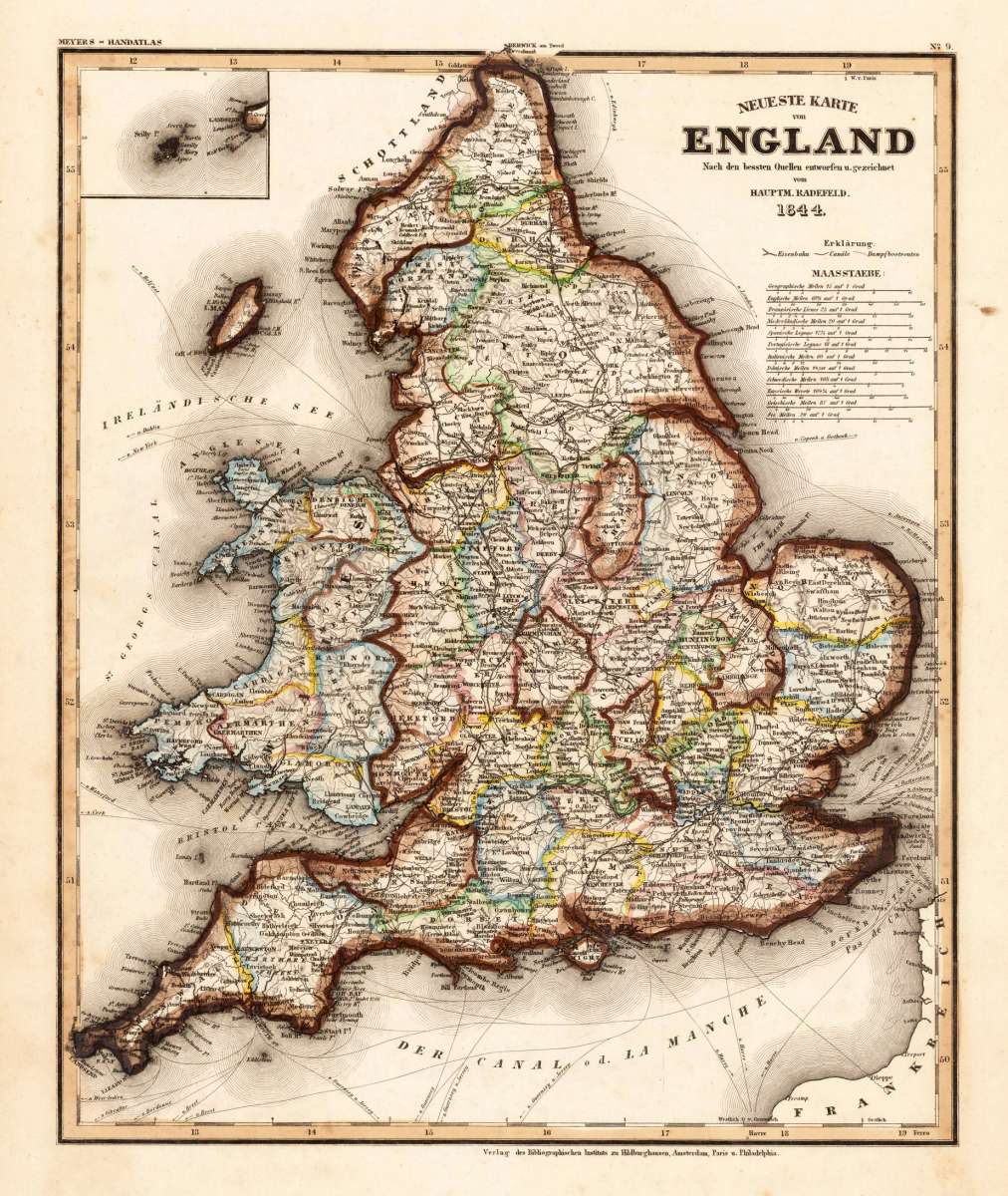
Eigenschaften
- Published: Bibliograph. Institut , Hildburghausen
- Published date: 1844
- Type: Antique Map, map
- Technique: Steel engraving, original color
- Category: England
- Issue date: 1844
- Size: 365 by 300mm (14¼ by 11¾ inches).
- Stock number: 17450
- Condition: In excellent condition.
Article description
Article description
Steelengraving, handcolored in outline when published. The detailled map of the British Isles is providing a lot of information on place names and rivers. As well shiproutes from English harbours into the North Sea are engraved. The map is equipped with a milage scale in various languages.You might also be interested in the following products

 De Custen van...
 Fascinating detailed seachart of the south-eastern coast of England showing the coastline from Lizard Point over...
€950.00
 Anglia Cambdeni,...
 Original antique copper engraving, hand colored in outline and wash when published. Decorative detailled map...
€195.00
 England...
 Steel engraving, handcolored in outline, when published. Small and decorative map of England, showing many place...
€40.00
Recently viewed products