Stülpnagel, F.
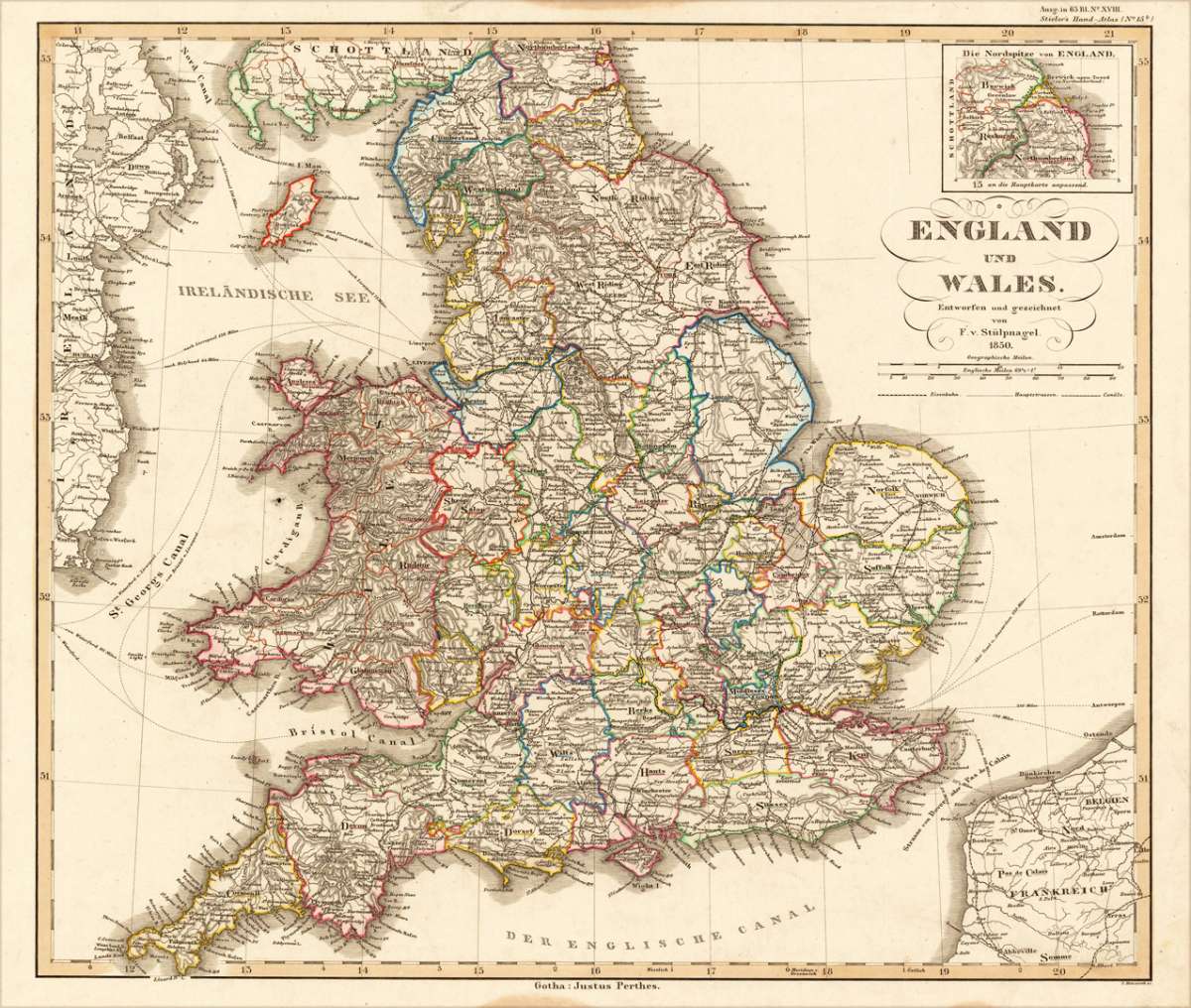
England und Wales Entworfen und gezeichnet von F.v. Stülpnagel 1850
€60.00
Prices incl. VAT plus shipping costs
This item is sold. Please contact us if you are searching for this item.
Eigenschaften
- Published: Ad. , Stieler
- Published date: 1850
- Type: Antique Map, map
- Technique: Steel engraving, original color
- Issue date: 1850.
- Category: England & Wales
- Size: 325 by 376mm (12¾ by 14¾ inches).
- Stock number: 17452
- Condition: In very good condition. A few marginal spots at the lower blank margin, not affecting the image. 325 by 376mm (12¾ by 14¾ inches).
Article description
Article description
Steel-engraved map, colored in outline, as published. In the upper right corner a small inset map with the northern tip of England. A highly detailled map providing a lot of information on small villages and place names, rivers, lakes, mountains, etc.You might also be interested in the following products

 De Custen van...
 Fascinating detailed seachart of the south-eastern coast of England showing the coastline from Lizard Point over...
€950.00
 Neueste Karte von...
 Steelengraving, handcolored in outline when published. The detailled map of the British Isles is providing a lot of...
€80.00
 Anglia Cambdeni,...
 Original antique copper engraving, hand colored in outline and wash when published. Decorative detailled map...
€195.00
Recently viewed products