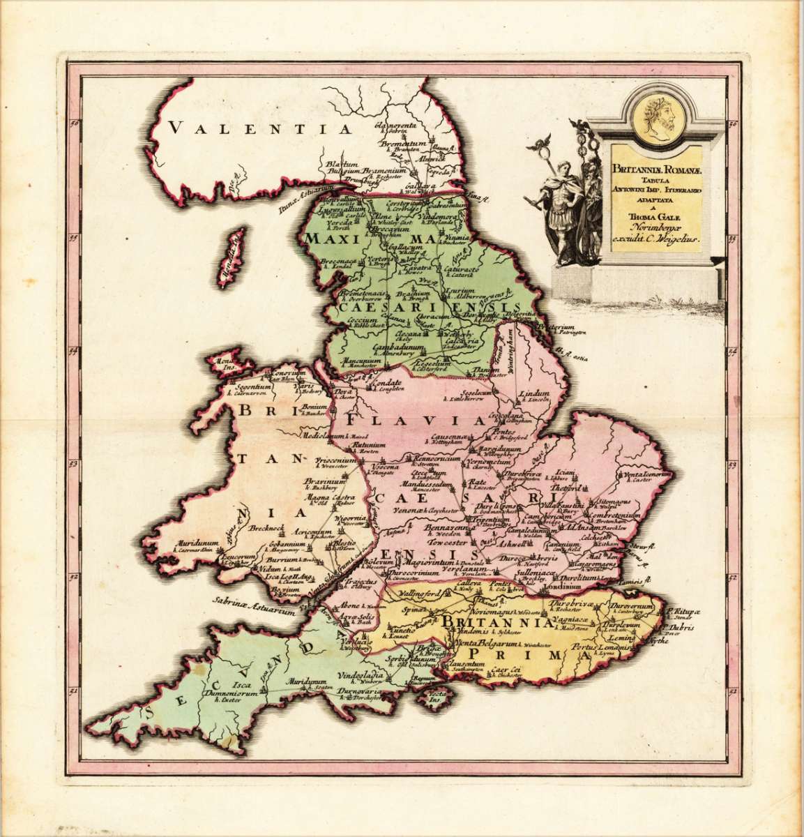
Weigel, Christoph
Britanniea Romanae Tabula Antonini Imp, Itinerario Adapta a Thoma Gale Norimbergea excudit. C. Weigelius.
Eigenschaften
- Published: C. Weigel , Nürnberg
- Published date: 1719
- Technique: Copper engraving / Original color.
- Type: Antique Map, map
- Issue date: 1719
- Category: Historical England
- Size: 335 by 315mm (13 by 12 inches).
- Stock number: 17460
- Condition: In excellent condition, full margins as published. 335 by 315mm (13 by 12 inches).
Article description
Article description
Original antique copper engraving, hand colored in outline and wash when published. Decorative detailled historical map showing the 'historical England', ornated in the upper right corner with a historical Roman figure and the title text. In full original body colour and outline colour, when published. Many antique place names are found on the map, as well streets and rivers. Johann Christoph Weigel, known as Christoph Weigel the Elder (9 November 1654 – 5 February 1725), was a German engraver, art dealer and publisher. He was born at Redwitz, Free imperial city of Eger in Egerland, and died in Nuremberg, aged 70. The cartographer Weigel worked around 1719 in Nürnberg and his maps are showing the typical style of this period in map making in Southern German. He worked very close as with Johann B. Homann in Nürnberg. All his maps were hand colored in outline and decorative body color immediatelly in his printing house, after they were printed.You might also be interested in the following products

 De Custen van...
 Fascinating detailed seachart of the south-eastern coast of England showing the coastline from Lizard Point over...
€950.00
 Neueste Karte von...
 Steelengraving, handcolored in outline when published. The detailled map of the British Isles is providing a lot of...
€80.00
 Anglia Cambdeni,...
 Original antique copper engraving, hand colored in outline and wash when published. Decorative detailled map...
€195.00
Recently viewed products