Sanson, Nicolas d'Abbeville
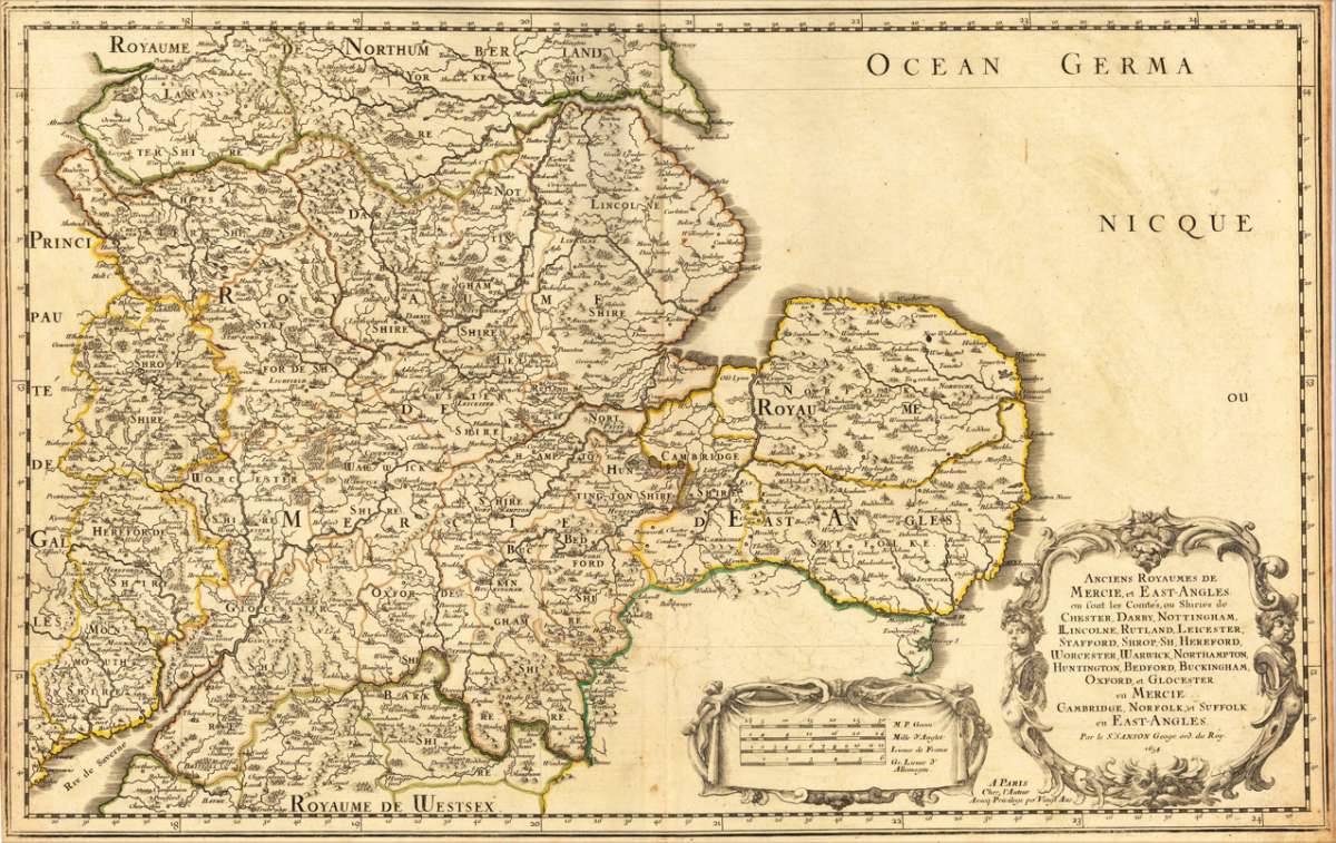
Anciens Royaumes de Mercie, et East-Angles: ou font les Comtés, ou Shiries de Chester, Darby, Nottingham, ILincolne,...
Eigenschaften
- Published: N. Sanson , Paris
- Published date: 1654
- Technique: Copper engraving / Original color.
- Type: Antique Map, map
- Issue date: 1654
- Category: Chester, Darbing, Nottingham, ...
- Size: 365 by 580mm (14¼ by 22¾ inches).
- Stock number: 17463
- Condition: In very good condition. 365 by 580mm (14¼ by 22¾ inches).
Article description
Article description
Copper-engraving, handcolored in outline, when published. Fine and strong impression of this early decorative mid-seventeenth century map of this English regional map covering the area Chester, Darbing, Nottingham, ... by the famous French cartographer Nicolaus Sanson. Very detailled and naming many cities and villages, as well many places along the coastline. Showing prominently the eastern part of central England. In the lower right corner with a large floral title cartouche and milage scale.You might also be interested in the following products

 De Custen van...
 Fascinating detailed seachart of the south-eastern coast of England showing the coastline from Lizard Point over...
€950.00
 Neueste Karte von...
 Steelengraving, handcolored in outline when published. The detailled map of the British Isles is providing a lot of...
€80.00
 Anglia Cambdeni,...
 Original antique copper engraving, hand colored in outline and wash when published. Decorative detailled map...
€195.00
Recently viewed products