Mortier, Pierre
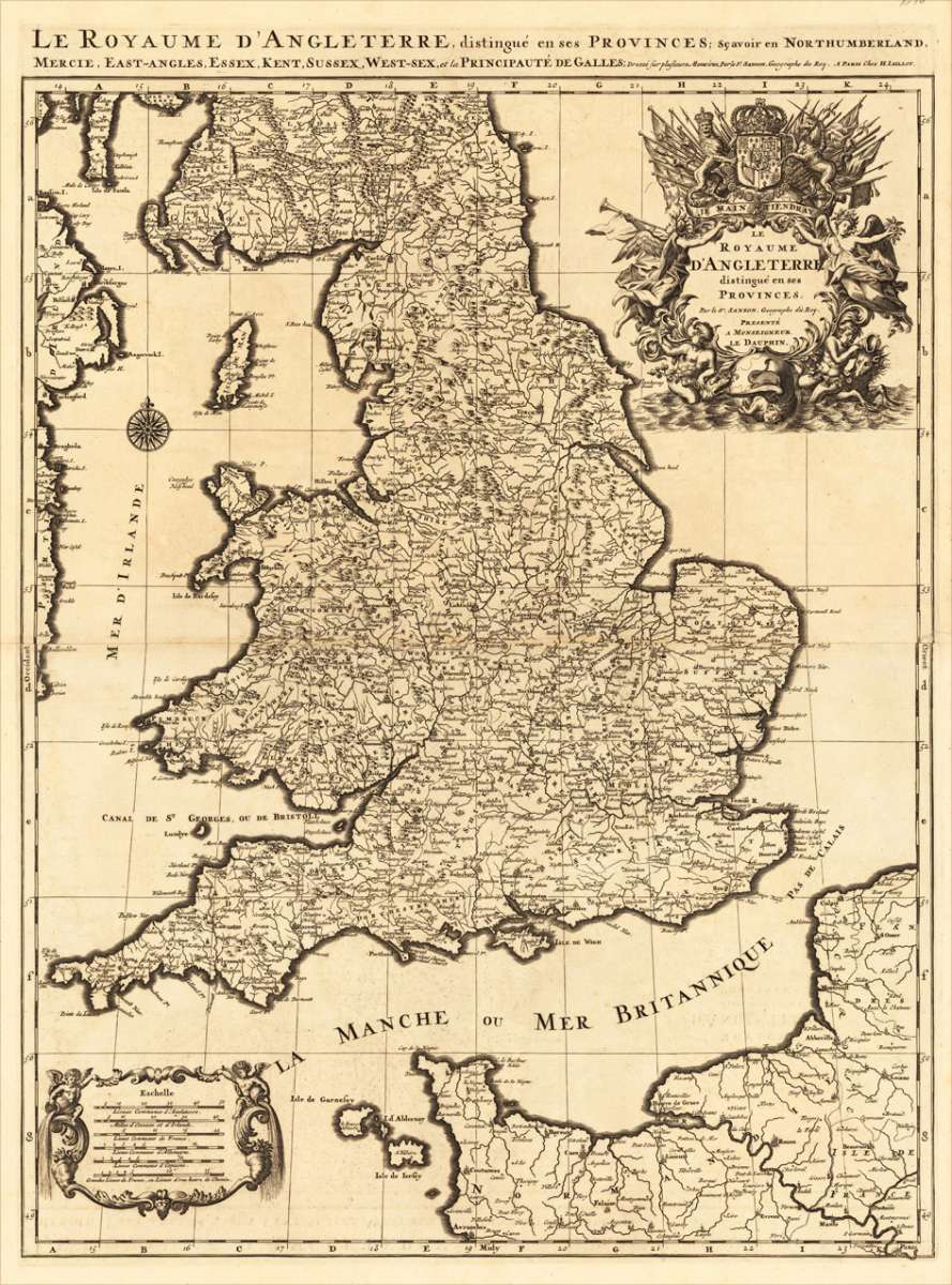
Le Royaume D'Angleterre, distingué en ses Provinces. Par le Sr. Sanson. Geographe du Roy. Presenté A Monseigneur...
Eigenschaften
- Published: Pierre Mortier , Amsterdam
- Published date: 1700
- Type: Antique Map, map
- Technique: Copper engraving / Uncolored
- Category: England
- Issue date: 1700.
- Size: 785 by 557mm (31 by 22 inches).
- Stock number: 17483
- Condition: A strong impression in excellent condition. 785 by 557mm (31 by 22 inches).
Article description
Article description
Copper-engraving, printed around 1700 by Pierre Mortier in Amsterdam, printed from two plates and published in his great atlas 'the Neptune Francois'. Pierre Mortier acquired the plates and rights for publication from Hubert Jaillot and published those maps with other maps by himself in his famous atlas project the 'Neptune Francois'. The maps are rich in detail, with many cities and place names, rivers, mountains, castles, etc. The map is ornated with a very large fine allegoric title cartouche with coat of arms in the upper right corner, as well a decorative cartouche with a milage scale in the lower left corner.You might also be interested in the following products

 De Custen van...
 Fascinating detailed seachart of the south-eastern coast of England showing the coastline from Lizard Point over...
€950.00
 Neueste Karte von...
 Steelengraving, handcolored in outline when published. The detailled map of the British Isles is providing a lot of...
€80.00
 Anglia Cambdeni,...
 Original antique copper engraving, hand colored in outline and wash when published. Decorative detailled map...
€195.00
Recently viewed products