Ptolemaeus, Claudius
Palaestina, Vel Terra Sancta
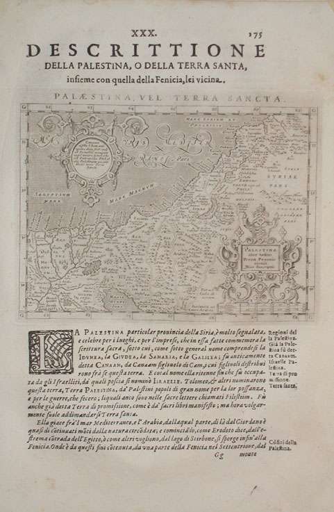
Eigenschaften
- Published: P & F. , Galignani
- Published date: 1621
- Type: Antique Map, map
- Technique: Copper engraving / Uncolored
- Category: Holy Land
- Issue date: 1621
- Size: 310 by 210mm (12¼ by 8¼ inches).
- Stock number: 17798
- Condition: A very good impression, in excellent condition. 310 by 210mm (12¼ by 8¼ inches).
Article description
Article description
Fine copper engraved map, printed into the full text page, published in 'Geografia ... Universale de la Terra', which was translated by Cernoti and published 1621 in Padua. A small decorative map fine engraved map showing Palestine. The map is ornated with two renaissance cartouches, also this interesting old map provides a lot of engraved place names, rivers, mountains, etc.You might also be interested in the following products
 Ierusalem aus den...
 Original antique copper engraving, hand colored in outline and wash when published. This map was published in the...
€250.00
 La Judée ou Terre...
 Copper engraving, hand colored in outline, when published. Detailed map by the French cartographer Sr. Robert de...
€295.00
 Victoire...
 Copper engraving, uncolored as published. Historical scene, showing an extensive land battle, in the background an...
€95.00
 Ambiméléch combat...
 Copper engraving, uncolored as published. Historical scene, showing an extensive land battle, in the background an...
€95.00
Recently viewed products