Vaugondy, Sr. Robert de
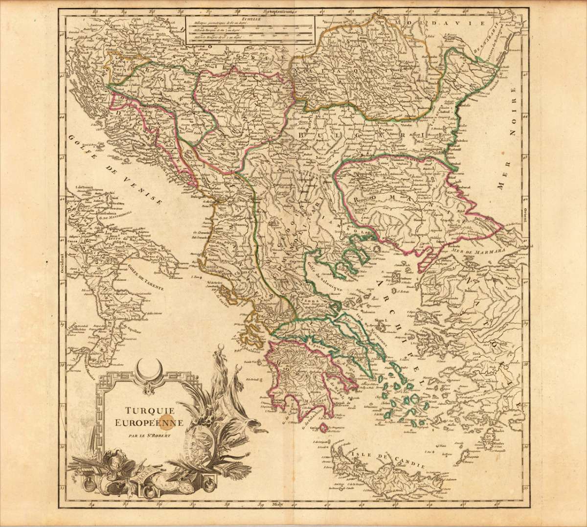
Turquie Europèenne - par le Sr. Robert
Eigenschaften
- Published: Sr. Robert , Paris
- Published date: 1780
- Technique: Copper engraving / Original color.
- Type: Antique Map, map
- Issue date: 1780
- Category: Southeast Europe & Balkan
- Size: 479 by 454mm (18¾ by 17¾ inches).
- Stock number: 18160
- Condition: In very good conditon. A slightly visable spot within the title cartouche. A slightly visable printer's crease near the centre-fold and on the right side of the map, else fine. 479 by 454mm (18¾ by 17¾ inches).
Article description
Article description
Copper engraving, handcolored in outline, when published. Fine and decorative map of Southeast Europe by Robert de Vaugondy, published in his atlas around 1780 by Delamarche. The interesting map shows 'Turkey in Europe' around 1780. The political divisions are shown in the contemporary outline colors. In the lower left corner with an armorial ornated title cartouche, a small mileage scale on the upper side. The map with many place names of cities and villages, roads, mountains, etc.You might also be interested in the following products
 General Karte Des...
 Steel engraving, hand colored in outline, when published. Decorative and interesting map showing the Osman Imperium,...
€75.00
 Europäische...
 Steel engraving, hand colored in outline when published. Detailed map of the Balkan, called the 'European...
€80.00
 Die Mitternächtig...
 Copper engraving, hand colored in outline and wash when published in Allain M. Mallet's description of the...
€60.00
 Die europaeische...
 Copper-engraving, handcolored in wash and outline. Small map of Southeast Europe showing mainly the posessions of...
€80.00
Recently viewed products