Homann, Johann Baptist
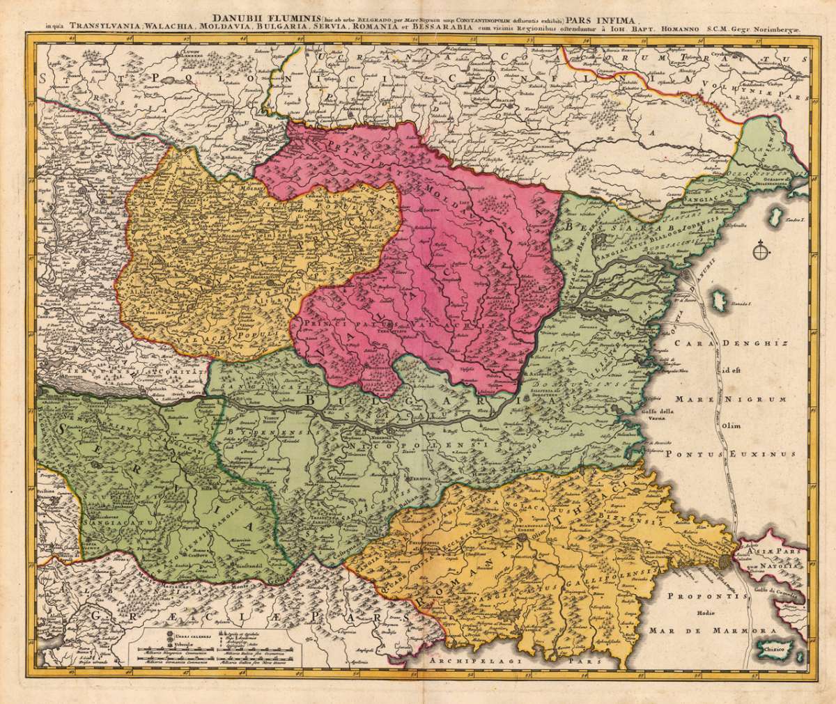
Danubii Fluminis (hic ab urbe Belgrado, per Mare Nigrum usq. Constantinoplim. defluentis exhibiti) Pars Infima, in...
€450.00
Prices incl. VAT plus shipping costs
This item is sold. Please contact us if you are searching for this item.
Eigenschaften
- Published: Homann , Nürnberg
- Published date: 1720
- Technique: Copper engraving / Original color.
- Type: Antique Map, map
- Issue date: 1720-30
- Category: Southeast Europe & Balkan
- Size: 488 by 583mm (19¼ by 23 inches).
- Stock number: 18251
- Condition: A strong impression in excellent condition.
Article description
Article description
Copper engraving, hand colored in outline when published. This decorative antique map shows us Transylvania, the Walachei, Bulgaria and Romania as well the neighboring Serbia. The map provides a lot of information on the political borders in that period, shows as well small place names, monasteries, mountains, rivers, lakes, etc. Further the map provides excellent information on the mouth of the river Danube into the 'Black Sea'. At the lower left bottom is a mileage scale.You might also be interested in the following products
 Walachia Servia,...
 Original antique copper engraving, hand colored in outline published in Joan Blaeu's 'Atlas Novus'....
€480.00
 Le Provincie di...
 Copper engraving, in contemporary original color in outline. Published in Zatta's 'Atlante Novissimo'....
€195.00
 Thraciae Veteris...
 Original antique copper engraving, published 1624 in the famous historical Atlas "Parergon" (Latin text-edition) by...
€480.00
 Walachia, Servia,...
 Original antique copper engraving, hand colored in outline published in Joan Blaeu's 'Atlas Novus'. This antique...
€395.00
Recently viewed products