Buchon, Jean Alexandre
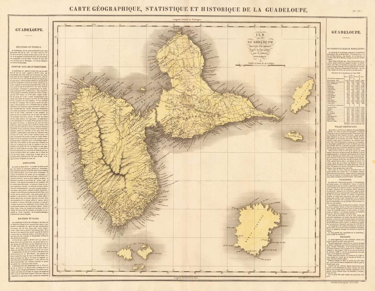
Carte Géographique, Statistique et Historique de la Guadeloupe. - Ile de la Guadeloupe dressée par Pierron, d`aprés...
Eigenschaften
- Published: Carez , Paris
- Published date: 1825
- Technique: Copper engraving / Original color.
- Type: Antique Map
- Issue date: 1825
- Category: Guadelupe
- Size: 457 by 482mm (18 by 19 inches).
- Stock number: 18591
- Condition: In excellent condition. 457 by 482mm (18 by 19 inches).
Article description
Article description
Copper engraving, handcolored in wash when published. Fine engraved map of the island of Guadeloupe in the West Indies showing detailed the island with many place names, bays, mountains, small islands and many rivers. With the neighboring small islands Marie Galante, Isle de Saintes, Petit Terre and la Desirade. The map is surrounded by descriptive text on Guadeloupe, providing information on the climate, the rivers, cities and its history.
You might also be interested in the following products
 Pas kaart Van de...
 Original antique copper engraving, finely hand colored in outline and wash, probably later hand color. Detailed...
€750.00
 Isle de la...
 Copper engraving, hand colored in outlineand wash. Detailed map showing detailed the Islands of Martinique,...
€95.00
 Isle De La...
 Copper-engraving, handcolored in outline, when published. A fine engraved, detailed map on the island of Martinique...
€136.00
 Martinico to...
 Decorative doublepage handcolored lithograph, showing decorative in a large scale the Island of Martinico, with an...
€268.00
Recently viewed products