Homann, Johann Baptist
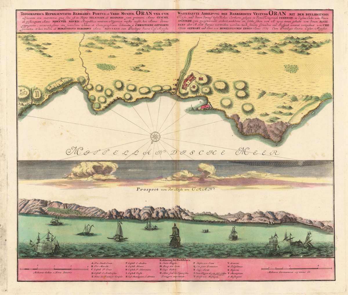
Topographica Repraesentatio Barbarici Portus et Urbis Munitae Oran una cum adjacente ora maritima, quae sita est in...
- Published: Homann , Nürnberg
- Published date: 1732
- Technique: Copper engraving / Original color.
- Type: Antique Map, map
- Issue date: 1732-40
- Category: Oran (Algeria)
- Size: 455 by 533mm (18 by 21 inches).
- Stock number: 18832
- Condition: In excellent condition. 455 by 533mm (18 by 21 inches).
Article description
Original antique copper engraving in contemporary hand color in wash and outline when published. This decorative prospect shows the coast near Oran in Algeria North Africa. The map provides two parts. At the top we see a ground plan from of the coast of Oran with mountains and a coastal profile. On the bottom we see the view of Oran from the sea towards the coast. The sea is equipped with many sailing ships some are firing. At the bottom of the map is a detailed explanation of the map with two mileage scales. Johann Baptist Homann (20 March 1664 – 1 July 1724) was a German geographer and cartographer, who also made maps of the Americas. Homann was born in Oberkammlach near Kammlach in the Electorate of Bavaria. Although educated at a Jesuit school, and preparing for an ecclesiastical career, he eventually converted to Protestantism and from 1687 worked as a civil law notary in Nuremberg. He soon turned to engraving and cartography; in 1702 he founded his own publishing house. Homann acquired renown as a leading German cartographer, and in 1715 was appointed Imperial Geographer by Emperor Charles VI. Giving such privileges to individuals was an added right that the Holy Roman Emperor enjoyed. In the same year he was also named a member of the Prussian Academy of Sciences in Berlin. Of particular significance to cartography were the imperial printing privileges (Latin: privilegia impressoria). These protected for a time the authors in all scientific fields such as printers, copper engravers, map makers and publishers. They were also very important as a recommendation for potential customers. In 1716 Homann published his masterpiece Grosser Atlas ueber die ganze Welt (Grand Atlas of all the World). Numerous maps were drawn up in cooperation with the engraver Christoph Weigel the Elder, who also published Siebmachers Wappenbuch. Homann died in Nuremberg in 1724. He was succeeded by his son Johann Christoph (1703-1730). The company carried on upon his death as Homann heirs company, managed by Johann Michael Franz and Johann Georg Ebersberger. After subsequent changes in management the company folded in 1852.[1] The company was known as "Homann Erben", "Homanniani Heredes", or "Heritiers de Homann" abroad. (Wikipedia)
You might also be interested in the following products
 Aegypti Tabula
  Etats du Roi de...
  Neueste Karte von...
  Neueste Karte von...