Mallet, Allain Manesson
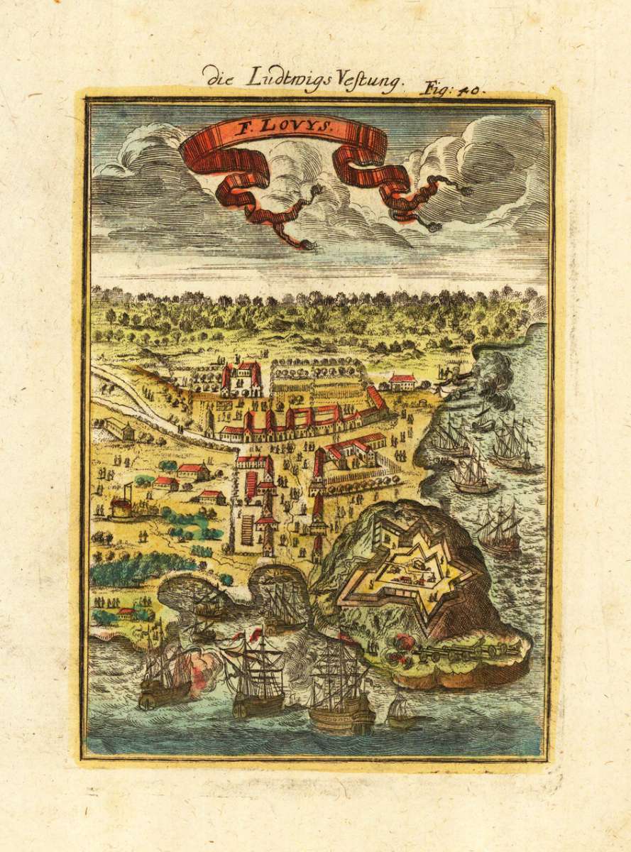
Die Ludtwigs Vestung - F. Lovys
Eigenschaften
- Published: Frankfurt
- Published date: 1719
- Type: Antique Map, map
- Technique: Copper engraving / later handcolor
- Issue date: 1719
- Category: Fort Louisbourg
- Size: 150 by 110mm (6 by 4¼ inches).
- Stock number: 19704
- Condition: In excellent condition. 150 by 110mm (6 by 4¼ inches).
Article description
Article description
Copper-engraving, handcolored in wash and outline. This antique map shows us the fortress of Louisbourg as a bird´s eye view. The decorative engraving with sailing ships in the foreground, the port of Louisbourg with its fortress and the nearby town.You might also be interested in the following products
 Pas kaart Vande...
 Original antique copper engraving, finely hand colored in outline and wash, probably later hand color. Detailed...
€600.01
 Guiana fiue...
 Copper engraving, hand colored in outline when published. A highly decorative map showing Guiana with the...
€400.00
 La Guyane...
 Original antique copper engraving, uncolored as published. This antique map shows French Guinea with many place...
€70.00
 Der Stadt Cayenne...
 Copper engraving, uncolored as published. Detailled map showing the fortified city Cayenne in French Guiana. With...
€55.00
Recently viewed products