Vandermaelen, Phillippe Marie
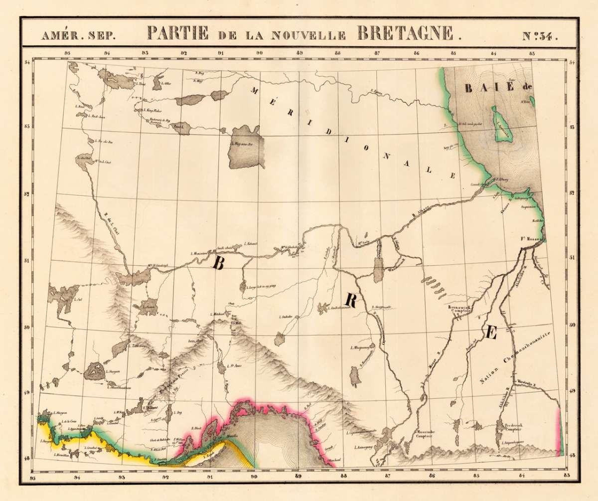
Amér. Sep. Partie de la Nouvelle Bretagne. No. 34.
€95.00
Prices incl. VAT plus shipping costs
This item is sold. Please contact us if you are searching for this item.
Eigenschaften
- Published: Brussels
- Published date: 1825
- Type: Antique Map
- Issue date: 1825
- Technique: Lithograph / Original color.
- Category: Lake Superior & Albany River
- Size: 474 by 568mm (18¾ by 22¼ inches).
- Stock number: 20547
- Condition: In excellent condition. 474 by 568mm (18¾ by 22¼ inches).
Article description
Article description
Lithograph, original hand colored in outline. Large and detailed map sowing the region from Lake Superior, R. Du L. Chat, L. Sturgeon, Hudson Bay and Albany River. Equipped with detailed information on the names of rivers and lake, mountains, Forts and Indian tribes. The map was published in Phillippe Marie Vandermaelen's atlas of North America.You might also be interested in the following products
 Pascaarte vande...
 Copper Engraving, uncolored by van Keulen, Joan, published 1684-1704 by Johannes van Keulen, Amsterdam. Image size:...
€1,100.00
 Britisches Nord -...
 Lithograph, original color in outline by Flemming, Carl, published 1845 - 50 by C. Flemming, Glogau. Image size: 310...
€84.00
 Johnson's...
 Lithograph, original color in outline by Johnson & Ward, published 1865 by Johnson & Ward, New York. Image...
€45.00
 Karte von den...
 Copper Engraving, uncolored by Bellin, Nicolaus, published 1753 by Merkur, Leipzig. Image size: 205 by 267mm (8 by 10...
€84.00
Recently viewed products