Lotter, Tobias Conrad
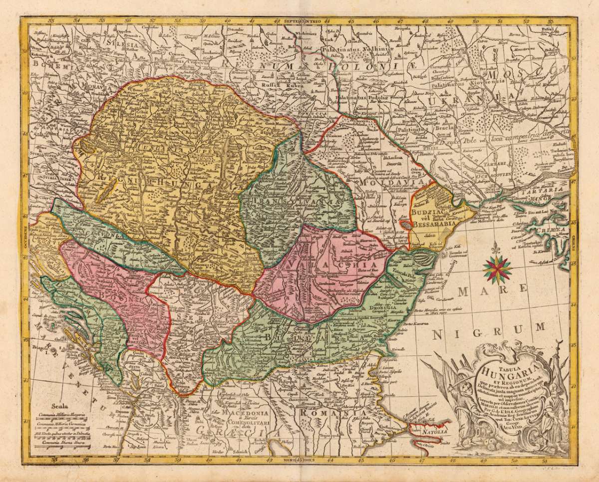
Tabula Hungaria et Regionum, quae praeterae ab ea dependent. Delineata juxta magnum numerum anotationum at mappas...
€395.00
Prices incl. VAT plus shipping costs
This item is sold. Please contact us if you are searching for this item.
Eigenschaften
- Published: Lotter , Augsburg
- Published date: 1762
- Technique: Copper engraving / Original color.
- Type: Antique Map
- Issue date: 1762
- Category: Hungary
- Size: 478 by 595mm (18¾ by 23½ inches).
- Stock number: 17312
- Condition: In excellent condition.
Article description
Article description
Copper engraving handcolored in wash and outline, when published. Engraved ca. 1762 by Georg Friedrich Lotter in Augsburg. Decorative map of Hungary with its neighbouring countries. This detailled map of Hungary with its neighbouring countries is engraved after Marsigli and further on based on the cartographic sources by de Guijelmus de L'Isle. The map is ornated by a large allegoric title cartouche in the lower right corner and a milage scale in the lower left corner.
You might also be interested in the following products
 Buda Ofen
 Original antique copper engraving, uncolored. Copper engraving of the siege of the western part of the city of...
€400.00
 The Bloxberg
 Original steel engraving, engraved by C. Cousen after W.H. Bartlett. Decorative, romantic view from Pesth over the...
€45.00
 City of Buda, or...
 Original steel engraving, engraved by R. Wallis after W.H. Bartlett. Decorative, romantic view towards Budapest.
€50.00
 Buda and Pesth...
 Original steel engraving, engraved by G.K. Richardson after W.H. Bartlett. Decorative, romantic panorama city-view...
€50.00
Recently viewed products