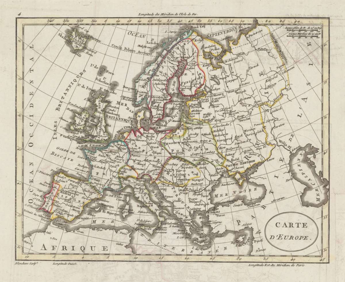
Blondeau
Carte D' Europe.
Carte D'Europe – Original Hand-Colored Copper Engraving · Lapie, Paris 1817 · Antique Map of Europe
Eigenschaften
- Published: Lapie , Paris
- Published date: 1817
- Technique: Copper engraving / Original color.
- Type: Antique Map, map
- Category: Europe
- Issue date: 1817
- Size: 178 by 227mm (7 by 9 inches).
- Stock number: 18916
- Condition: In excellent condition. 178 by 227mm (7 by 9 inches).
Article description
Article description
Original copper engraving with hand-applied outline color, by engraver Blondeau, published by the celebrated French military cartographer Pierre Lapie, Paris, 1817. Image: 178 x 227 mm (7 x 9 inches). A crisp, well-preserved small-format map of Europe — a fine collector's piece from the Napoleonic era. Pierre Lapie (1779–1850) was a Colonel in the French army's corps of topographical engineers and one of the foremost cartographers of the early 19th century. Working in Paris, he produced four major atlas publications distinguished by their precise engraving and informational density, and his work strongly influenced the commercial cartography of mid-19th-century Germany. Lapie's maps are held in the Bibliothèque nationale de France and major research collections worldwide. This small-format map depicts the continent of Europe with its major kingdoms and regions clearly delineated, including Spain, France, the British Isles, Scandinavia, the German states, Italy, Turkey, Greece, Russia, and part of North Africa. Rivers, mountain ranges, and major place names are engraved throughout. The hand-applied outline color highlights the political borders of the period — a Europe freshly reorganized in the aftermath of the Napoleonic Wars. A clean and attractive collector's piece. In excellent condition. Colors vivid and unfaded. No tears, creases, or foxing. Ready to frame. 178 x 227 mm.Carte D'Europe – Original Hand-Colored Copper Engraving · Lapie, Paris 1817 · Antique Map of Europe
You might also be interested in the following products
 Europa
 Original copper engraving with hand-applied outline color, published by Tranquillo Mollo — Vienna's leading map...
€110.00
 Romania Imperii...
 Original copper engraving of the Eastern Roman Empire after the geographic text of Michel'Antoine Baudrand,...
€295.00
 Geographia...
 Rare and decorative large-format historical map of Europe showing the locations of Church Councils and Synods, in...
€322.43
 Karte der...
 Original color lithograph mapping the main seismic impact zones in Central Europe, by the renowned German...
€25.00
Recently viewed products