Theunis, Jacobsz & Lootsman, Jacob and Casparus
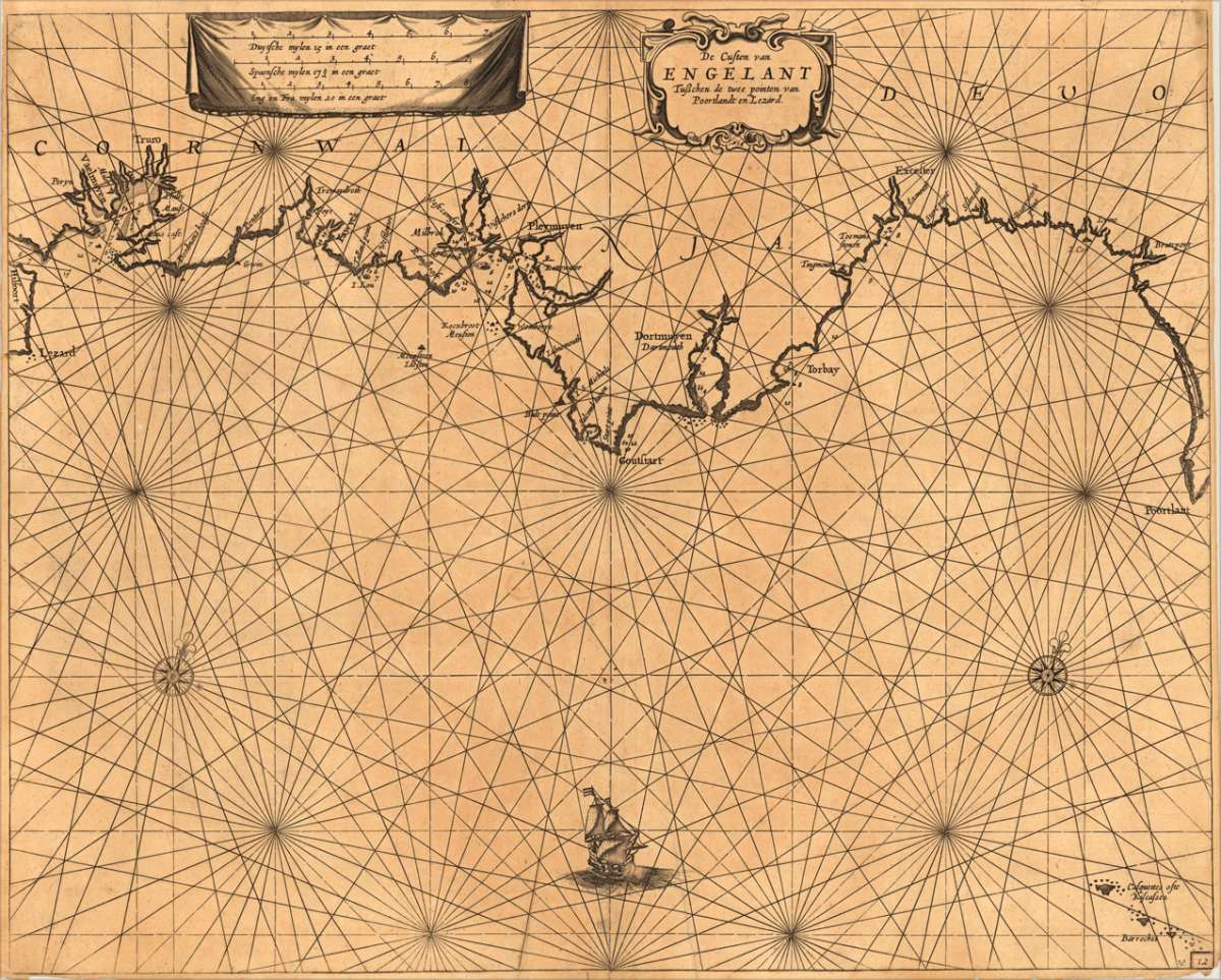
De Custen van Engelant tusschen de twee pointen van Poortlandt en Lezard.
Eigenschaften
- Published: Jacques & Gasper Anthoine , Amsterdam
- Published date: 1662
- Type: Antique Map, map
- Technique: Copper engraving / Uncolored
- Issue date: 1662
- Category: Seachart of the south-eastern coast of England (Cornwall and Devonshire)
- Size: 431 by 538mm (17 by 21¼ inches).
- Bibliography: Koeman Jac. 14 (and a variant of Jac 33) #44
- Stock number: 15969
- Condition: A strong impression in very good condition. There is a minor marginal fraying of the paper on the lower margin of the mapsheet, just beneath the lower engraved border line (full margins as published). 431 by 538mm (17 by 21¼ inches).
Article description
Article description
Fascinating detailed seachart of the south-eastern coast of England showing the coastline from Lizard Point over Plymouth, Torquay, Exeter towards Portland. In the very lower right corner the 'Kiscases' and 'Barroches' islands are marked. The map is ornated near the upper left corner with a large decorative cartouche, containing a milage scale to convert Dutch, Spanish, English & French leagues to degrees, right near it is the title-cartouche, the map is as well decorated with a large ship and two compass-roses. Along the coastline several villages and towns are marked, as well anchor places in the bays, sandbanks are shown, mostly with detailed information on the water-depths.
Koeman Jac. 14 (and a variant of Jac 33) #44
You might also be interested in the following products
 Accuratissima...
 Copper engraving, hand colored in outline when published. A very detailed and rare old map of England and Walles...
€480.00

 Neueste Karte von...
 Steelengraving, handcolored in outline when published. The detailled map of the British Isles is providing a lot of...
€80.00
 England und Wales...
 Steel-engraved map, colored in outline, as published. In the upper right corner a small inset map with the northern...
€60.00
Recently viewed products