Ortelius, Abraham
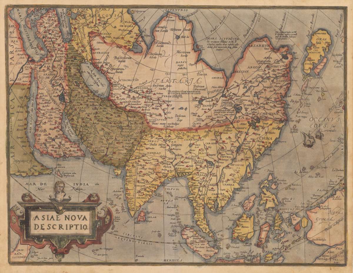
Asiae Nova Descriptio.
- Published: Christopher Platin , Antwerp
- Published date: 1580
- Technique: Copper engraving / Original color.
- Type: Antique Map, map
- Category: Asia
- Issue date: 1580
- Size: 376 by 489mm (14 by 19 inches).
- Bibliography: Broe. 7.
- Stock number: 17201
- Condition: A very good example in excellent condition and original colors. 376 by 489mm (14 by 19 inches).
Article description
Original copper engraving, oldcolored, published 1582 in Antwerpen in the atlas "Theatrum Orbis Terrarum". This is the 2nd plate of Ortelius's 'Asia Nova Descriptio'. It has the lower case 'Farfana' and the town 'Ara' has disapeared. The map is finely hand-colored in wash and outline, when published. A colored title cartouche is in the lower left corner. Villages and towns are shown as miniature views, moreover the map is ornated with sea monsters. A highly decorative 16th century map of Asia. Ortelius was born on 14 April 1527 in the city of Antwerp, which was then in the Habsburg Netherlands (modern-day Belgium). The Orthellius family were originally from Augsburg, a Free imperial city of the Holy Roman Empire. In 1535, the family had fallen under suspicion of Protestantism. Following the death of Ortelius's father, his uncle Jacobus van Meteren returned from religious exile in England to take care of Ortelius. Abraham remained close to his cousin Emanuel van Meteren, who would later move to London. In 1575 he was appointed geographer to the king of Spain, Philip II, on the recommendation of Arias Montanus, who vouched for his orthodoxy. He travelled extensively in Europe and is specifically known to have traveled throughout the Seventeen Provinces; in southern, western, northern, and eastern Germany (e.g., 1560, 1575–1576); France (1559–1560); England and Ireland (1576); and Italy (1578, and perhaps twice or thrice between 1550 and 1558). Beginning as a map-engraver, in 1547 he entered the Antwerp Guild of Saint Luke as an illuminator of maps. He supplemented his income trading in books, prints, and maps, and his journeys included yearly visits to the Frankfurt book and print fair, where he met Gerardus Mercator in 1554. In 1560, however, when travelling with Mercator to Trier, Lorraine, and Poitiers, he seems to have been attracted, largely by Mercator's influence, towards the career of a scientific geographer. (Wikipedia)
Broe. 7.
You might also be interested in the following products
 Nouvelle...
  Asia
Asia  Von den Ländern...
  Von den Ländern...