Seutter, Matthäus
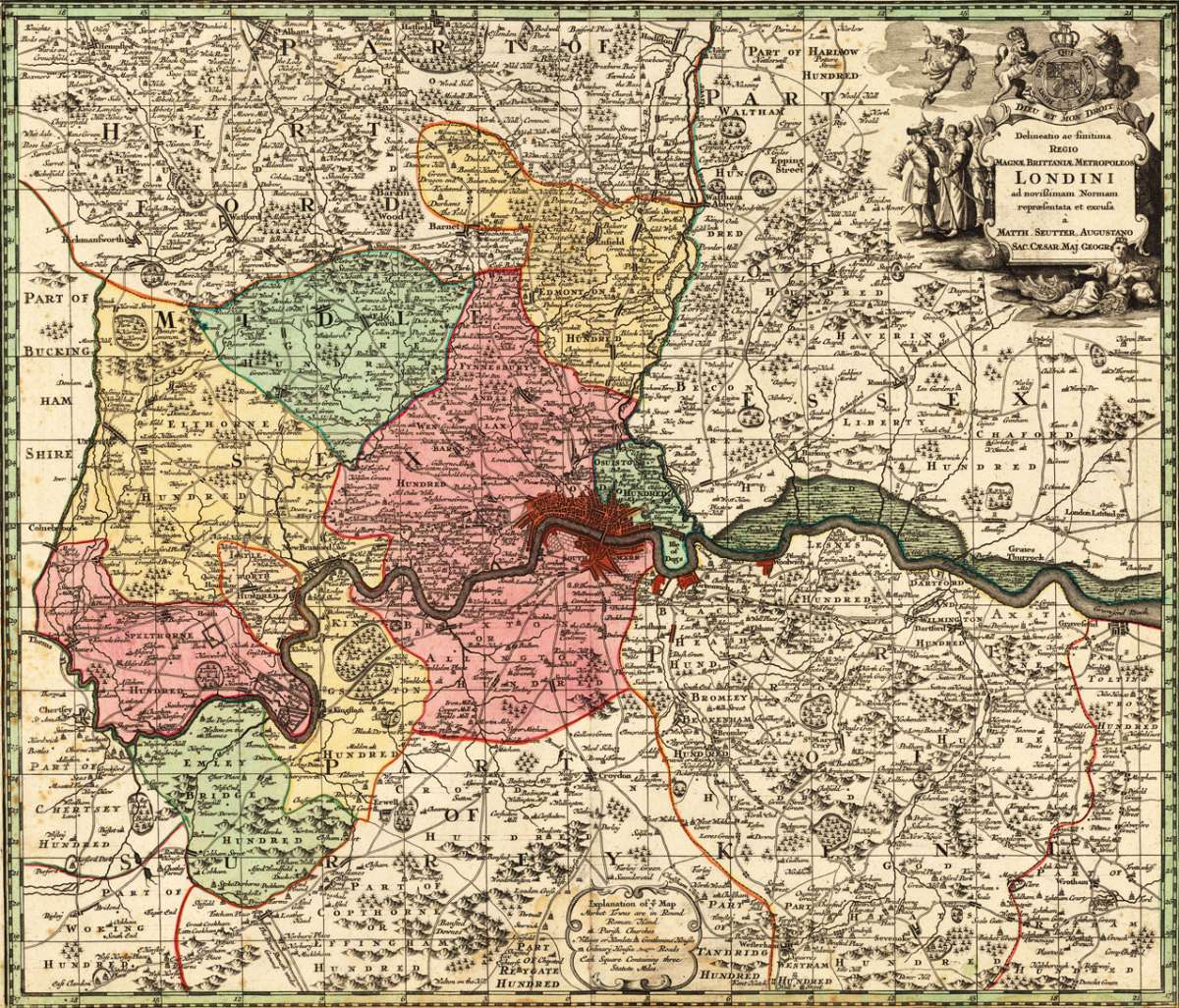
Delineatio ac finitima Regio Magnae, Brittaniae Metropoleos Londini ad novißimam Normam repraesentata et ecusa à...
€595.00
Prices incl. VAT plus shipping costs
This item is sold. Please contact us if you are searching for this item.
Eigenschaften
- Published: M. Seutter , Augsburg
- Published date: 1720
- Technique: Copper engraving / Original color.
- Type: Antique Map, map
- Issue date: 1720-40
- Category: London area
- Size: 502 by 586mm (19¾ by 23 inches).
- Stock number: 17475
- Condition: In very good condition. A strong impression in orginal colors, printed on the full double page sheet, as published. The lower margin slightly narrow, but not cut within the image of the map. A few marginal spots. 502 by 586mm (19¾ by 23 inches).
Article description
Article description
Copper engraving, handcolored in wash and outline when published. The detailled map shows the greater area arount London, including the areas Kent, Essex, Middlesex and a part of Surrey. With many engraved place names, streets, castles and monastries. As well rivers, lakes,mountains and forests are shown.
You might also be interested in the following products
 Accuratissima...
 Copper engraving, hand colored in outline when published. A very detailed and rare old map of England and Walles...
€480.00

 De Custen van...
 Fascinating detailed seachart of the south-eastern coast of England showing the coastline from Lizard Point over...
€950.00
 Neueste Karte von...
 Steelengraving, handcolored in outline when published. The detailled map of the British Isles is providing a lot of...
€80.00
Recently viewed products