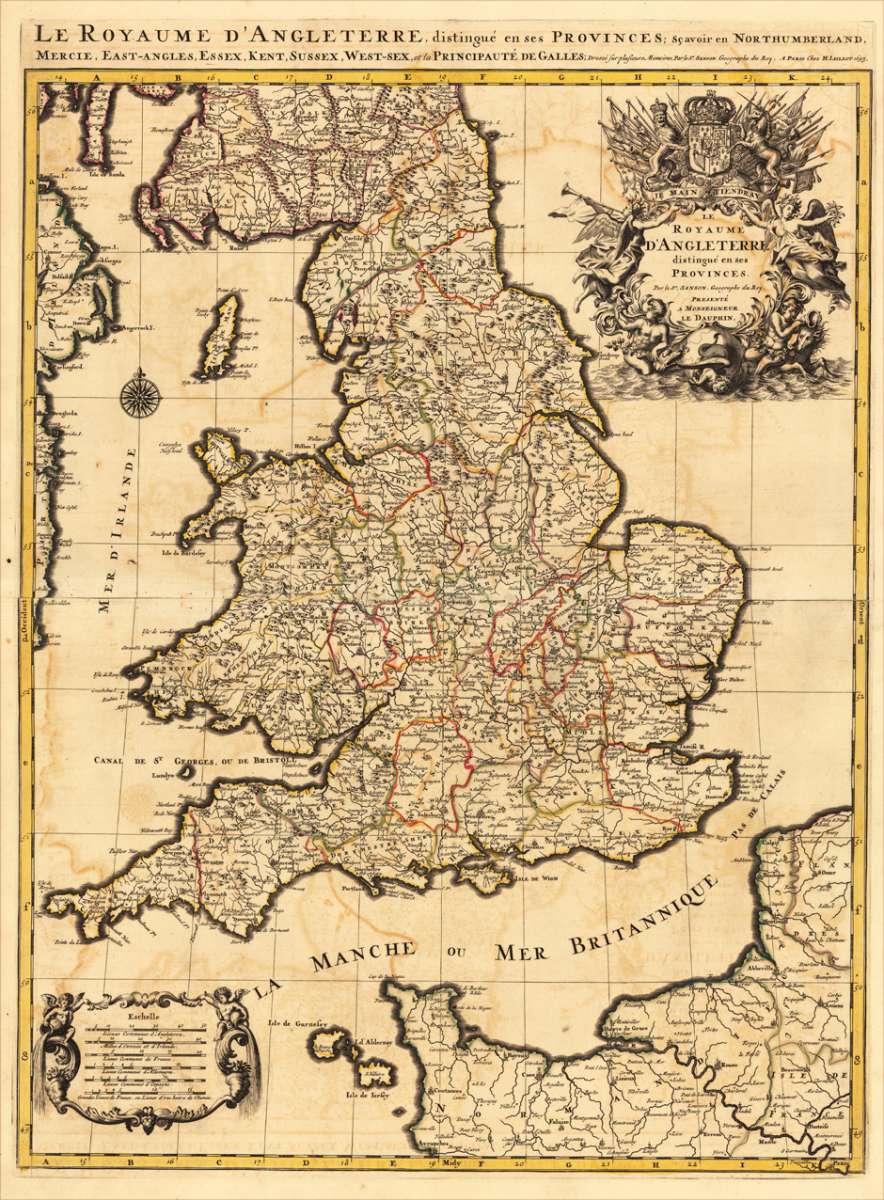
Jaillot, Alexis-Hubert & Sanson, N.
Le Royaume D'Angleterre, distingué en ses Provinces. Par le Sr. Sanson. Geographe du Roy. Presenté A Monseigneur...
Eigenschaften
- Published: H. Jaillot , Paris
- Published date: 1693
- Technique: Copper engraving / Original color.
- Type: Antique Map, map
- Category: England
- Issue date: 1693
- Size: 757 by 582mm (29¾ by 23 inches).
- Stock number: 17484
- Condition: In very good condition. 757 by 582mm (29¾ by 23 inches).
Article description
Article description
Copper-engraving handcolored in outline, when published. Minor offsetting of the old outline colors to the paper. Printed around 1693 by Hubert Jaillot in Paris, printed from two plates and published in his great atlas the 'Atlas Noveau ...'. Large and decorative map of England by the French cartographer Nicolaus Sanson and Hubert Jaillot. Published in the 'Atlas Noveau ...', this atlas was a masterpiece in the French cartography in the 17th century. The atlas was specially designed for Louis XIV and due of the very large size of the plates, most maps were printed from two plates, it took Hubert Jaillot over 12 years to complete the 'Atlas Noveau ...'. England is very detailled shown on the map, as well the various counties are shown in engraved territory borders. The maps are rich in detail, with many cities and place names, rivers, mountains, castles, etc. The map is ornated with a very large fine allegoric title cartouche with coat of arms in the upper right corner, as well a decorative cartouche with a milage scale in the lower left corner.You might also be interested in the following products
 Accuratissima...
 Copper engraving, hand colored in outline when published. A very detailed and rare old map of England and Walles...
€480.00

 De Custen van...
 Fascinating detailed seachart of the south-eastern coast of England showing the coastline from Lizard Point over...
€950.00
 Neueste Karte von...
 Steelengraving, handcolored in outline when published. The detailled map of the British Isles is providing a lot of...
€80.00
Recently viewed products