Güssefeld, F.L.
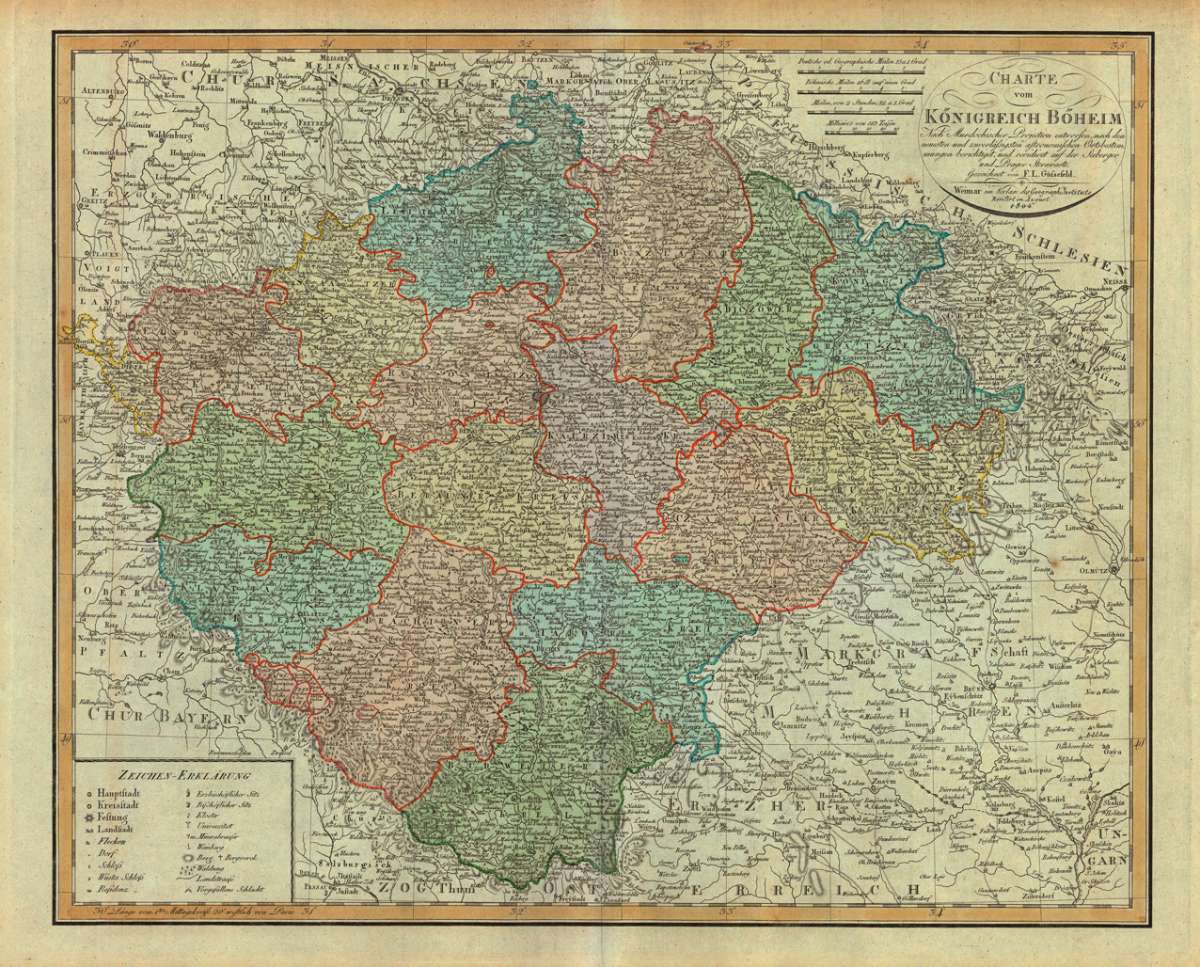
Charte vom Königreich Böheim - Nach Murdochischer Projection entworfen, nach den neuesten und zuverlässigsten...
€195.00
Prices incl. VAT plus shipping costs
This item is sold. Please contact us if you are searching for this item.
Eigenschaften
- Published: Geographisches Institut , Weimar
- Published date: 1804
- Technique: Copper engraving / Original color.
- Type: Antique Map
- Issue date: 1804
- Category: Böhmen
- Size: 466 by 571mm (18¼ by 22½ inches).
- Stock number: 20961
- Condition: In excellent condition.
Article description
Article description
Copper engraving, hand colored in outline and wash when published.
This detailed antique map shows the region between Meissen in the north and Passau in the south, Olmütz in the east and Greitz in the west. The title cartoushe and four different milegage scales are in upper right corner. The legend is engraved in the lower left corner.
You might also be interested in the following products
 Marienbad -...
 Original antike Lithographie, unkoloriert. Dargestellt wird auf dieser sehr detaillierten Lithographie der Blick...
€220.00
 Carlsbad
 City view of the city of Carlsbad (Karlsbad), published in the Topographia Bohemiae by Matthaeus Merian.
€245.00
 Mappa Geographica...
 Original antique copper engraving, hand colored in outline and wash when published. In the upper left is a beautiful...
€220.00
 Le Royaume de...
 Original antique copper engraving, hand colored in outline. Decorative and detailed 18th century map of the French...
€175.00
Recently viewed products