Visscher, Nicolaus
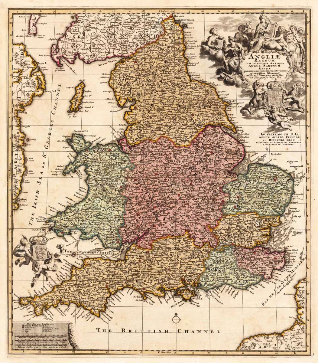
Angliae Regnum tam in septem Antiqua Anglo-Saxonum Regna quam in omnes Hodiernas Regiones accuratissime distinctum...
- Published: N. Visscher , Amsterdam
- Published date: 1680
- Technique: Copper engraving / Original color.
- Type: Antique Map, map
- Category: England
- Issue date: 1680-90
- Size: 561 by 491mm (22 by 19 inches).
- Stock number: 23962
- Condition: Due of the old oxidation in the old colors, the reverse side of the map was carefully filled with paper fibers. In very good to excellent condition. 561 by 491mm (22 by 19 inches).
Article description
Copper engraving, hand colored in outline and wash. Decorative antique map showing England, Isle of Man and a part of Scotland. This highly decorative rare map of the late 17th century is equipped with a large allegoric title cartouche in the upper right corner, further at the left side with engraved coat of arms held by angels. At the bottom a small mileage scale with a ornament on the right side. With many engraved place names and details, the political borders shown in outline and wash color of the period as published.
Nicolaes Visscher (25 January 1618, Amsterdam – buried 11 September 1679, Amsterdam) was a Dutch engraver, cartographer and publisher. He was the son of Claes Janszoon Visscher. His son, Nicolaes Visscher II (1649–1702), also worked with him and continued the family tradition of mapmaking after his death. Visscher died in Amsterdam in 1679 and was buried in the Nieuwezijds Kapel on 11 September of that year, though a death year of 1709 is maintained by some sources.
His engraved double hemisphere map, Orbis Terrarum Nova et Accuratissima Tabula, was created in 1658 in Amsterdam. It also contains smaller northern and southern polar projections. The border is decorated with mythological scenes, one in each corner, drawn by the painter Nicolaes Berchem, showing Zeus, Neptune, Persephone and Demeter. It is an early example of highly decorated Dutch world maps. (Wikipedia)
You might also be interested in the following products
 Accuratissima...
 De Custen van...
  Neueste Karte von...